

Latest Weather Blog
Threat for severe thunderstorms continues east of Baton Rouge through 5pm

Click HERE to watch WBRZ streaming live online
Trending News
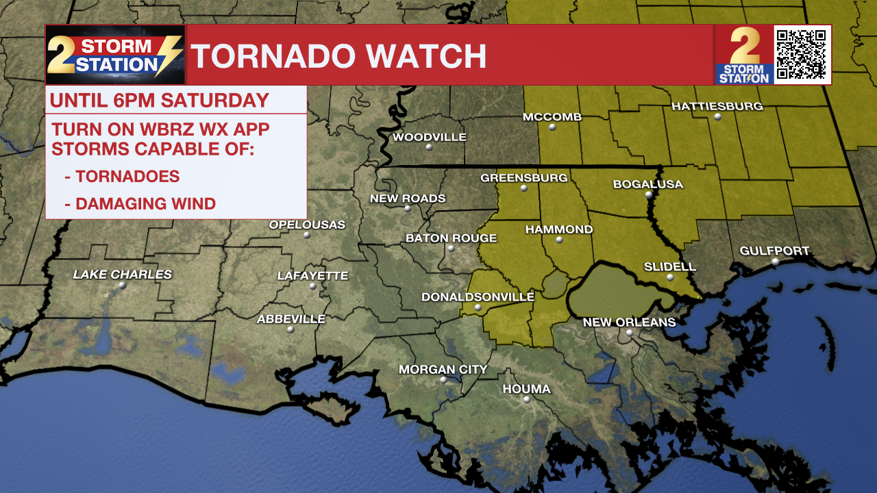
A TORNADO WATCH means conditions are favorable for tornadoes and/or damaging winds in and around the watch area. Be on the lookout for threatening weather conditions and listen for later statements and possible warnings. If a Tornado Warning is issued, seek shelter in a low-level, interior room of a sturdy building. Take pets (on a leash) with you, have on hard-soled shoes, monitor storm coverage on a wireless device, and cover your head in the event of wind or tornado impact. For more on tornado safety, CLICK HERE.
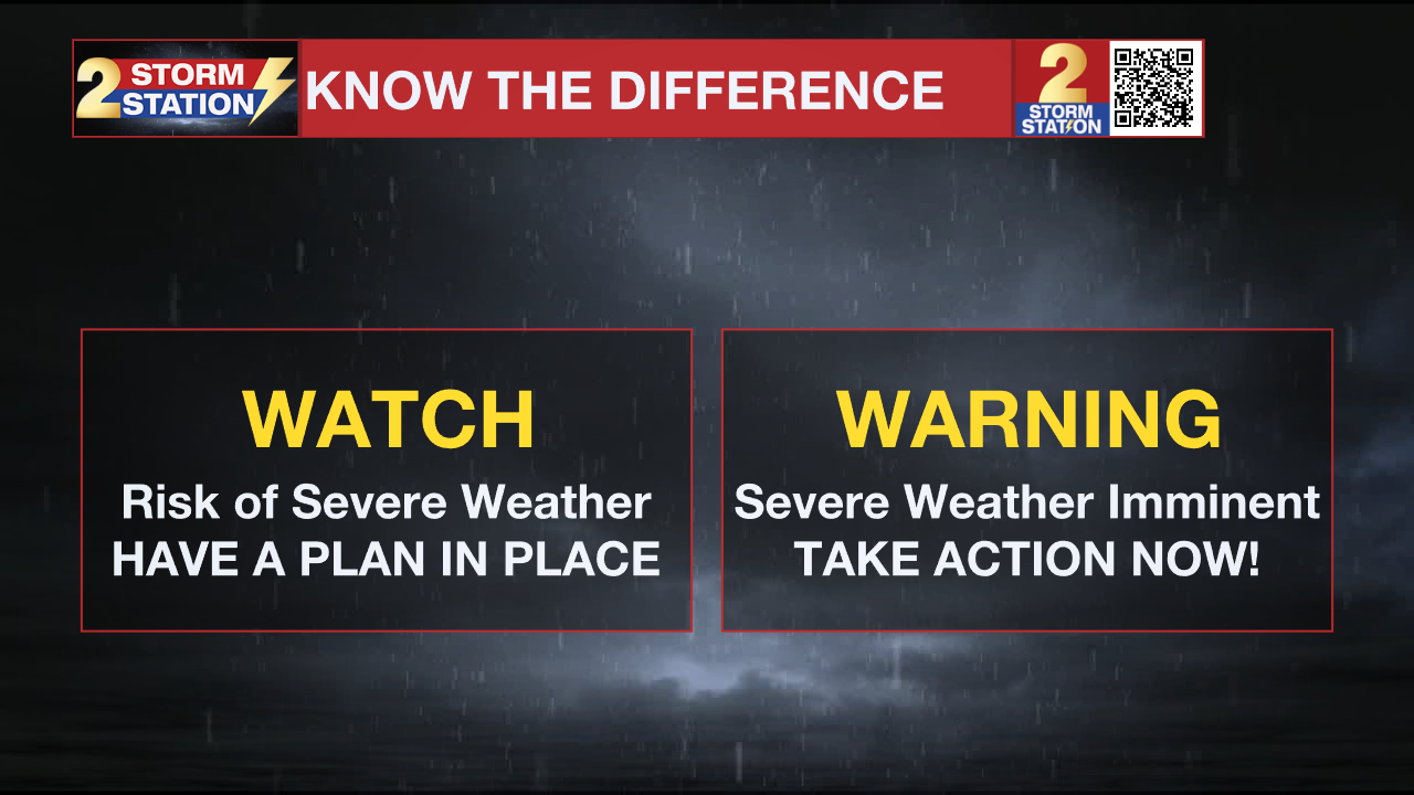
Know the difference between a watch and a warning. If a Tornado Warning is issued for your location, take action as you are in an immediately life-threatening situation. Move to a small, low-level, interior room away from windows if possible. Sit on the floor and cover your head. If you are in a mobile home or vehicle, there is no safe place to be! Get out, and seek shelter in the nearest sturdy building.
Remember that the WBRZ WX App. is *free* on Apple and Android devices and can be used for breaking weather information, live radar, and forecast details. You can also use it to watch live coverage if power or broadcast signal is ever lost. For even more, connect with the Storm Station on Twitter and Facebook. Stream WBRZ+ for continuous information as it becomes available.

Severe Weather Threat: Showers and thunderstorms are expected through 5 p.m. Saturday. Especially from late morning into the afternoon, some of these thunderstorms could be severe. The potential exists for tornadoes (some strong), damaging winds, and hail. The Storm Prediction Center has assigned an uncommon (1-2 times per year, locally) Level 4/5 “Moderate Risk” of severe weather for the majority of the Capital Area, including Baton Rouge, Denham Springs, Gonzales and Hammond to name a few cities. Generally, this means numerous severe thunderstorms are expected within the risk area, and some storms could be particularly intense. Given that the storm mode will be cellular and not a line, many will not see any severe weather. However, the point locations that do see these severe storms could see very significant impacts. For that reason, every warning needs to be taken seriously today, especially Tornado Warnings. By the evening, the associated cold front should push east, bringing quieter conditions.
Up Next: Just in time for 40th Wearin’ of the Green Parade and St. Patrick’s Day festivities, Sunday will bring a major shift in the weather—cooler, drier air will settle in, dropping highs to a comfortable 73°F with plenty of sunshine. Monday and Tuesday look fantastic as well, with highs in the mid to upper 70s under mostly sunny skies. By Wednesday, temperatures will climb back to 80°F, with just a slight chance of rain returning.
Get the latest 7-day forecast and real-time weather updates HERE.
Watch live news HERE.
– Storm Station Team
The Storm Station is here for you, on every platform. Your weather updates can be found on News 2, wbrz.com, and the WBRZ WX App on your Apple or Android device. Follow WBRZ Weather on Facebook and X for even more weather updates while you are on the go.
Posts below are from the WBRZ Weather X account. Monitor for weather warnings below.
More News
