Two weather stories will shape the forecast through the weekend as the last impacts from Bertha end today while dangerous heat quickly returns. Sunshine takes over Friday, and Heat Advisories are likely through the weekend as temperatures climb back into the upper 90s.

Today and Tonight: Today will be hot and mostly dry with plenty of sunshine. Afternoon highs will reach the middle 90s, while heat index values climb into the lower 100s. Although an isolated afternoon shower can't be ruled out, most communities will stay rain-free. Tonight will remain warm and muggy with lows in the upper 70s under mostly clear skies.
Up Next: The heat intensifies through the weekend and into early next week. High temperatures will climb into the middle and upper 90s, with a few spots nearing 100 by Sunday and Monday.
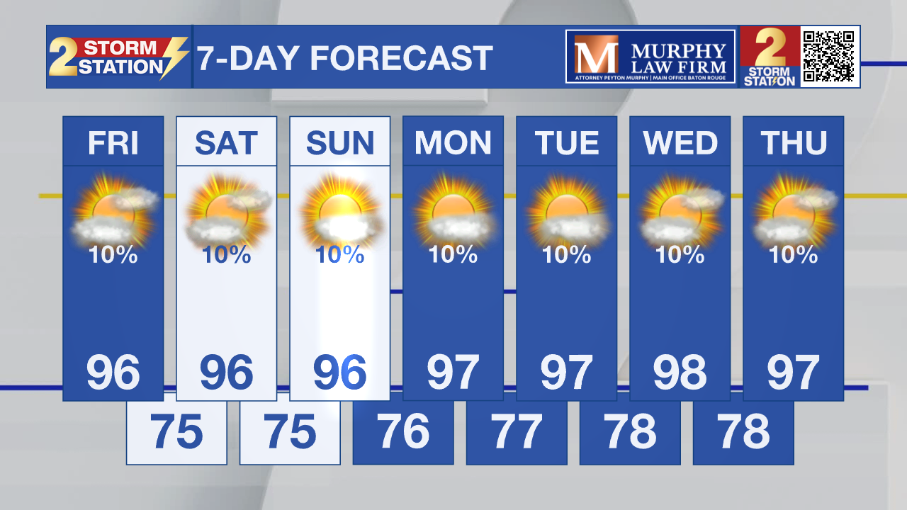
Heat index values are expected to remain just below advisory levels today and Saturday before reaching Heat Advisory criteria Sunday. By Monday through Wednesday, peak heat index values of 110 to 115 degrees are possible, making a prolonged period of dangerous heat increasingly likely. Rain chances remain very low, with only a stray afternoon thunderstorm offering isolated and temporary relief.
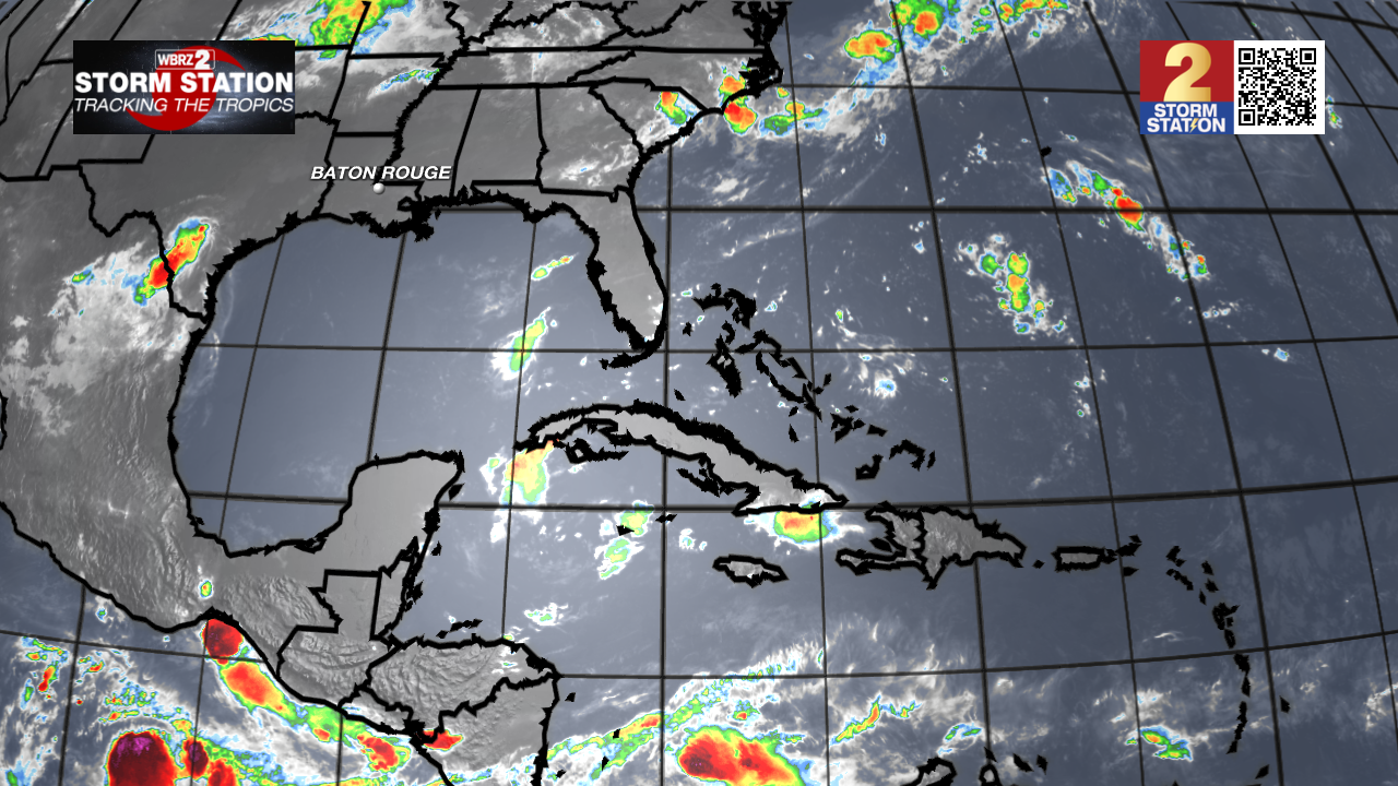
Tropics: The tropics are quiet once again. The National Hurricane Center has issued its final advisory on the remnants of Bertha, now located over east Texas, and no tropical cyclone development is expected anywhere across the Atlantic Basin during the next seven days.
Get the latest 7-day forecast and real-time weather updates HERE.
Watch live news HERE.
– Dave
The Storm Station is here for you, on every platform. Your weather updates can be found on News 2, wbrz.com, and the WBRZ WX App on your Apple or Android device. Follow WBRZ Weather on Facebook and X for even more weather updates while you are on the go.