Friday AM Forecast: More storms to end workweek, Drying up for weekend plans
The end to the Capital Area's dry spell will continue Friday as more showers and storms move through the region. Conditions will then turn dry and warm for the first weekend of November.
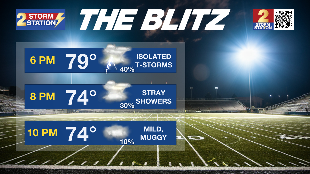
Today & Tonight: A few lingering showers early Friday will keep roadways slick during the commute. Cloudy skies will remain all Friday as more rounds of showers and thunderstorms move through the region. It will not be raining at all times today, but periods of heavy rain and thunderstorms will disrupt outdoor activities. Rain will begin to dwindle by nightfall, although a poncho may be needed during high school football this evening. With the clouds and rain around, temperatures will barely warm above 80 degrees this afternoon.

Rain will dry up and skies will slowly begin to clear into the overnight hours. Saturday morning will see temperatures in the upper 60s with a muggy feel to the air.
Up Next: The first weekend of November will keep the same well above average warmth the Capital Area experienced in October. Mornings will begin with lows in the upper-60s and afternoons will warm into the upper 80s under partly sunny skies. The air may feel a bit sticky but rain chances will come to a halt over the weekend. Similar conditions will continue into the first full workweek of the month. By late next week, there is a slight signal that drier, less humid air will return although no significant cooldown is in sight.
Get the latest 7-day forecast and real time weather updates HERE.
Trending News
Watch live news HERE.
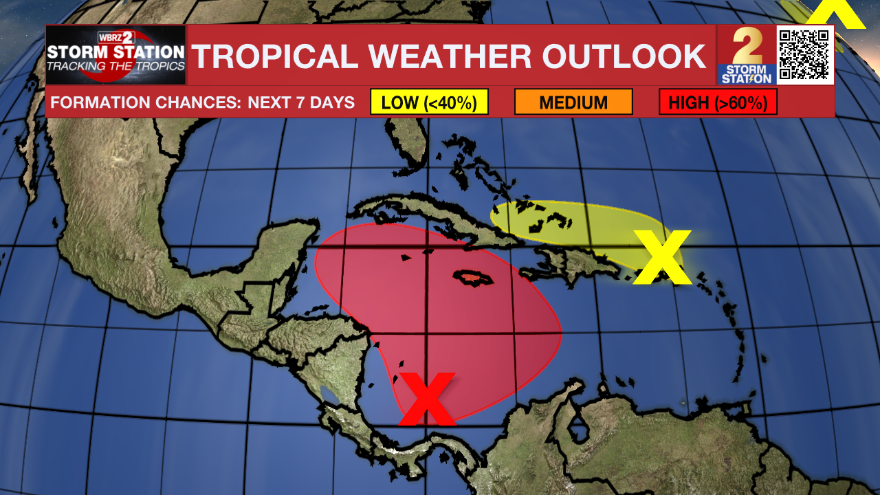
The Tropics: A broad area of low pressure is likely to develop over the southwestern Caribbean Sea during the next day or so. Gradual development is possible thereafter, and a tropical depression is Likely to form late this weekend or early next week while the system drifts generally northward or northwestward over the central or western Caribbean Sea. Regardless of development, locally heavy rains are possible over portions of the adjacent land areas of the western Caribbean.

A trough of low pressure located near Puerto Rico is producing a large area of showers and thunderstorms over portions of the Greater Antilles and the adjacent waters of the Atlantic and the northeastern Caribbean. Slow development of this system is possible during the next few days as it moves west-northwestward near the Greater Antilles. After that time, this system is expected to be absorbed into the low pressure area over the Caribbean. Regardless of development, locally heavy rains are possible during the next several days from the northern Leeward Islands westward across Puerto Rico and Hispaniola to eastern Cuba and the southeastern Bahamas.
Showers and thunderstorms have developed near the center of a storm-force non-tropical low pressure area located about 550 miles west of the western Azores. However, any additional development into a subtropical or tropical cyclone is expected to be slow to occur as the system moves eastward during the next few days.
– Emma Kate C.
The Storm Station is here for you, on every platform. Your weather updates can be found on News 2, wbrz.com, and the WBRZ WX App on your Apple or Android device. Follow WBRZ Weather on Facebook and Twitter for even more weather updates while you are on the go.


