

Latest Weather Blog
Friday AM Forecast: Offshore storms will slowly progress inland through weekend
This morning, storms in the northern Gulf tried moving inland but were mostly evaporated by dry air. As we head into the weekend, especially Sunday, showers and storms should make more inland progress.
Today & Tonight: Throughout the morning and into the afternoon hours, a few stray showers will be possible. The overwhelming vast majority will stay 100% dry. Highs will make it to near 88 degrees under mostly sunny skies. It will feel a touch muggy at times, but overall humidity levels will not be that high. Once again, conditions will cooperate for some Friday night football action! Overnight, expect a few clouds with lows near 67 degrees.
The Weekend: An organizing area of low pressure will continue to spark storms in the northern Gulf. On Saturday, some of these will spread inland, but drier air will limit the inland progress. Most showers and storms will stay closer to the coast, and south of the interstates. Higher moisture content will begin to work further north on Sunday. This will allow showers and storms to spread further inland. A widespread washout is not expected, as most activity will stay hit-and-miss in nature. Rain totals will stay under an inch for the most part, with higher totals closer to the coast. Highs will top out in the mid to upper 80s, with lows near 70 degrees.
Early Next Week: Rain coverage will gradually move down each day next week. Meanwhile, humidity will hit a peak as evidenced by lows sitting near 70° for a couple of days. Afternoons will not be characterized by extreme summer-like heat, but highs may flirt with 90°.
Trending News
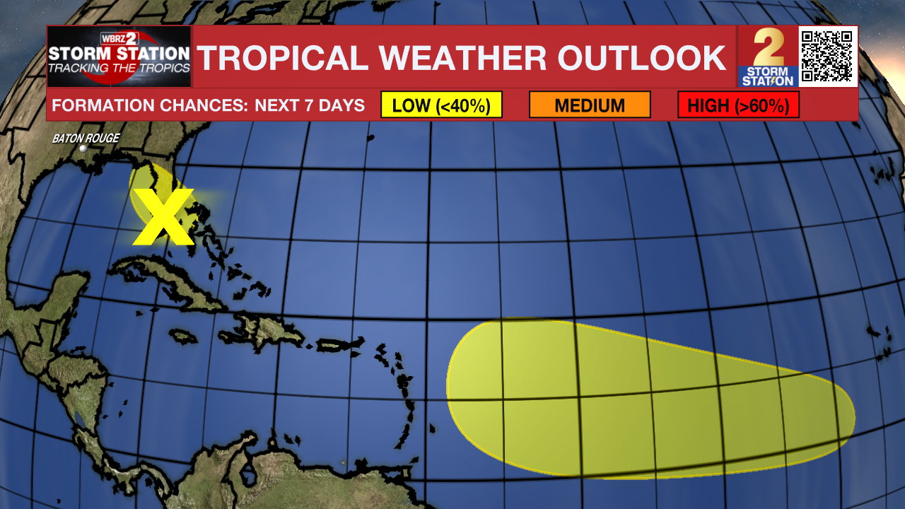
The Tropics:
Southwest Atlantic & Northeast Gulf – An area of low pressure may form along a remnant frontal boundary near the northwestern Bahamas and southern Florida during the next day or two. Any additional development is expected to be slow to occur as the system moves northwestward across the Florida Peninsula and into the Gulf of America.
Central Tropical Atlantic – A tropical wave is expected to move off the coast of Africa over the next day or two. Thereafter, this wave is forecast to interact with another disturbance in the eastern tropical Atlantic, and some slow development of the combined feature is possible as the system moves westward to west-northwestward at 15 to 20 mph.
Get the latest 7-day forecast and real-time weather updates HERE.
Watch live news HERE.
— Balin
The Storm Station is here for you, on every platform. Your weather updates can be found on News 2, wbrz.com, and the WBRZ WX App on your Apple or Android device. Follow WBRZ Weather on Facebook and X for even more weather updates while you are on the go.
More News
