

Latest Weather Blog
Monday AM forecast: Foggy mornings and warm afternoons
Dense fog greets parts of the Capital Region this morning, with spring-like warmth building this week. While visibility may be reduced early, temperatures remain well above normal and rain chances stay limited through midweek.

Today and tonight: A Dense Fog Advisory is in effect through mid-morning for parts of the Capital Region. Visibility may be reduced at times early, but conditions improve after sunrise as fog lifts and high clouds thin. The afternoon turns warm for early February, with highs reaching the mid to upper 70. Tonight stays mild, with increasing low-level moisture and the potential for widespread fog redeveloping late.

Use the slider to advance through the next 24 hours of Futurecast
Up Next: Tuesday remains warm and mostly dry, with highs again well into the 70s and a few inland locations possibly approaching 80 degrees. A weak system moves closer late Tuesday night into Wednesday, bringing a chance for scattered showers, though rainfall amounts appear light and many areas may stay dry. Warm weather continues through the late week before another system approaches next weekend.
Trending News
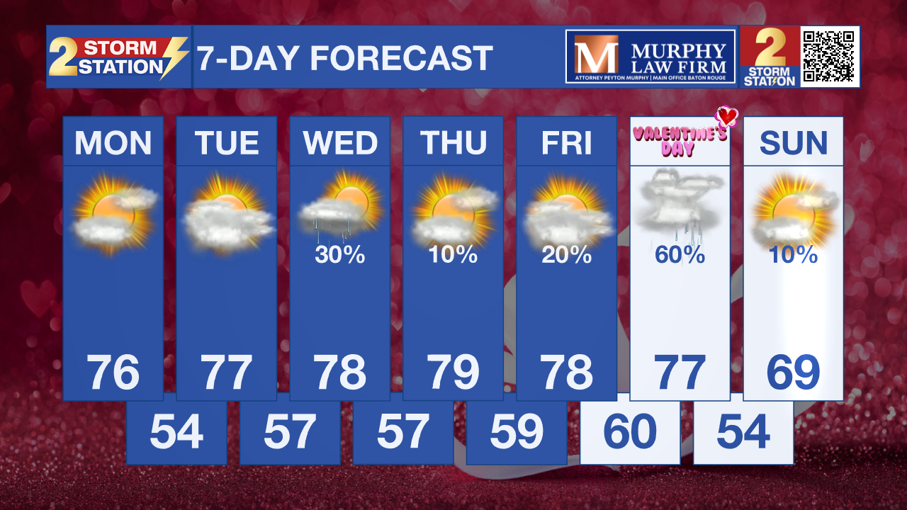
What to look out for: Fog will be the primary concern the next few mornings, especially during the early commute, with visibility potentially dropping quickly in spots. Temperatures will stay unusually warm for February, and while rain chances remain low through midweek, forecast confidence decreases heading into the weekend with a possible system that could bring showers or storms that could impact Mardi Gras fun.
Get the latest 7-day forecast and real-time weather updates HERE.
Watch live news HERE.
– Dave
The Storm Station is here for you, on every platform. Your weather updates can be found on News 2, wbrz.com, and the WBRZ WX App on your Apple or Android device. Follow WBRZ Weather on Facebook and X for even more weather updates while you are on the go.
More News
