Monday PM Forecast: Eyes on the next rainmaker, set to arrive between a pair of fronts
After collecting nearly an inch or more of rainfall around the Capital Area over the weekend, Veteran's Day will kickoff the new workweek with much drier conditions. Our next rainmaker is set to arrive by midweek.
Tonight & Tomorrow: Skies clear out on Monday night as a weak front will pass through before stalling out near the coast. Lower humidity will be left behind, helping to drop overnight lows. Look for a morning low near 61° in Baton Rouge. Tuesday starts off with lots of sunshine. By afternoon, expect nothing more than a few clouds. It will be warm with a high in the low 80s, which runs about 10° above average. Despite a break in humidity early on, it slowly returns as the day progresses. The steamy feel will make a comeback by Tuesday night.
The Next Impact: The Capital Area will experience a surge in moisture on Wednesday. The humidity appears to climb to summertime levels. That, in tandem with an approaching upper-level disturbance, will bring another round of showers and thunderstorms to the region. This is the next impact. Isolated showers arrive as early as the predawn hours on Wednesday. Activity will continue through the day, and perhaps into the night before exiting late. Do keep in mind that roads might be wet for both the morning and evening commutes. A few storms might repeat, or train, over the same location producing localized instances of nuisance flooding or standing water. A rogue strong to borderline severe storm isn't out of the question either with gusty winds being the primary threat.
The Front That Follows: On Thursday, a cold front will approach and eventually push through the region. This will end rain chances from west to east. A cooler and less humid air mass will trail said front. Highs will dip into the upper 70s with lows down into the 50s. Although relatively cooler, even these temperatures are above the averages for this time of year. The wait continues for a significant blast of cooler air.
Get the latest 7-day forecast and real time weather updates HERE.
Trending News
Watch live news HERE.

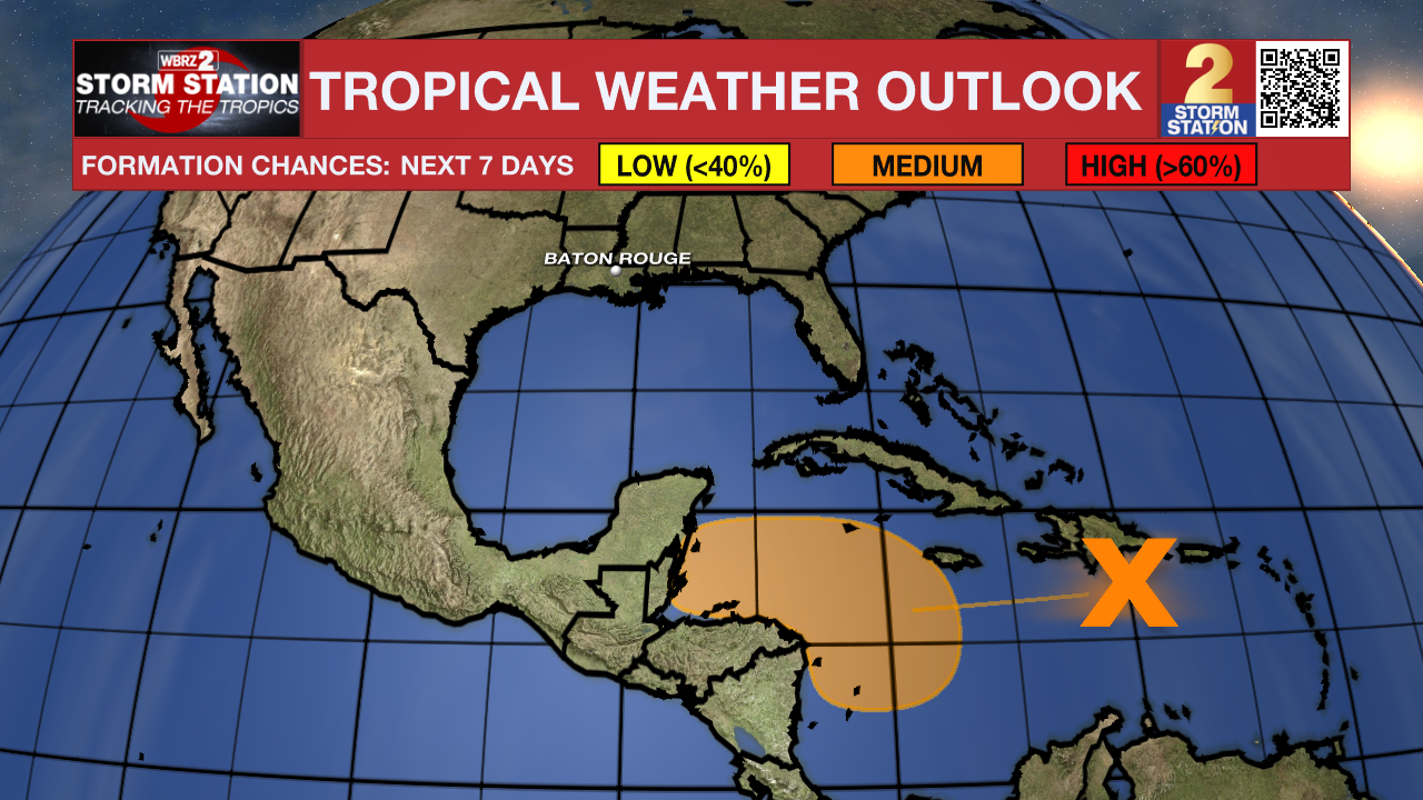
The Tropics: With no active tropical systems in the Atlantic Basin, attention now shifts to a tropical wave south of Hispaniola over the central Caribbean Sea. This system will move westward at a slow pace during the next few days. Gradual development is possible as this happens. A tropical depression could form late this week or this weekend while the wave meanders over the western Caribbean Sea. For now, this system does not appear to pose a threat to Louisiana.
-- Meteorologist Malcolm Byron
The Storm Station is here for you, on every platform. Your weather updates can be found on News 2, wbrz.com, and the WBRZ WX App on your Apple or Android device. Follow WBRZ Weather on Facebook and X for even more weather updates while you are on the go.


