

Latest Weather Blog
Monday PM Forecast: From jackets to T-shirts, riding a daily temperature seesaw
Very dry air will accomplish two things moving forward: keeping rain away and resulting in rather large temperature swings from morning to afternoon. The next week will be characterized by a daily back-and-forth from jacket to T-shirt weather.
Tonight & Tomorrow: Don’t count on a Tuesday morning start in the 40s. Passing high clouds will limit the amount of cooling that takes place, keeping temperatures in the 60s through around midnight. Those clouds will eventually thin out by daybreak, leaving enough time for lows to bottom out in the mid-50s. Even so, that’s chilly enough to require an extra layer early on; however, a mainly sunny sky will push temperatures into the 70s by lunchtime, on the way to a high in the low 80s by afternoon.

Up Next: Expect jacket weather every morning this coming week, with low temperatures consistently dropping into the low-to-mid 50s. That extra layer won't be needed for long, as afternoon highs steadily climb into the 80s. The large gap from morning low to afternoon high is driven by a very dry air mass, which heats and cools much faster. Said dry air will also keep the Capital Area void of any rainfall for the time being.
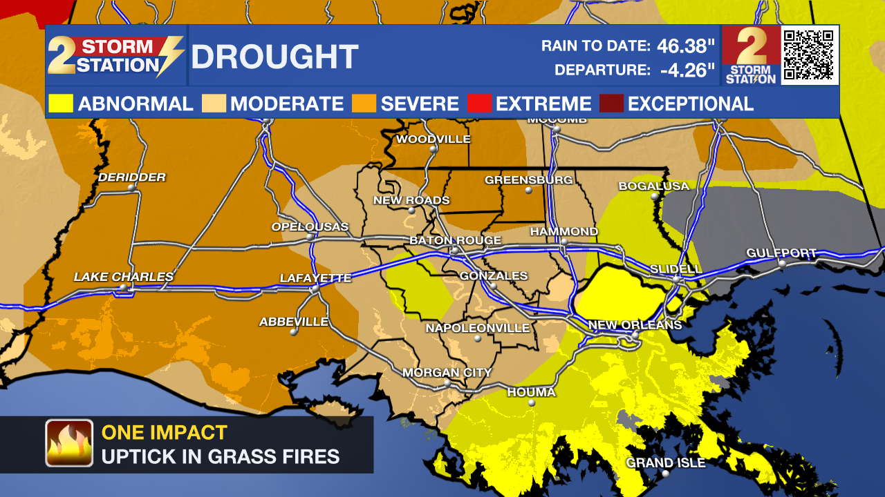
The lack of rain only amplifies drought concerns. Dry vegetation often increases the risk of grass fires in fall, so do exercise caution when burning, even without an official Red Flag Warning.
Trending News
Get the latest 7-day forecast and real-time weather updates HERE.
Watch live news HERE.
The Tropics: An area of low pressure is located along a front a few hundred miles off the Southeast Coast. The system is already producing tropical-storm-force winds, but isn’t truly tropical in nature at this time. Should the disturbance detach from fronts and begin acquiring energy from the warm Gulf Stream, subtropical development would be possible toward mid-to-late week. A subtropical storm is a hybrid system of sorts that draws power from both warm ocean water (tropical source) and the clash of warm/cool air in the atmosphere (extratropical source).
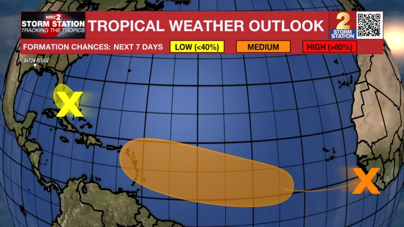
Regardless of development, the storm will cause high winds, coastal flooding, and dangerous surf along parts of the East Coast. The next name up is Josephine.
— Meteorologist Malcolm Byron
The Storm Station is here for you, on every platform. Your weather updates can be found on News 2, wbrz.com, and the WBRZ WX App on your Apple or Android device. Follow WBRZ Weather on Facebook and X for even more weather updates while you are on the go.
More News

