Saturday AM Forecast: End of weekend storms followed by major cool down
The Storm Station will be tracking a strong line of storms set to move through the Capital Area late Sunday. After the system clears, a blast of artic air will take over the Capital Region and result in very chilly conditions next week.
Today & Tonight: Clouds that moves in overnight will stick around all Saturday. A spotty shower or two may be able to squeeze out of them during the day. Temperatures in the morning that begin near 50° will struggle to warm due to the overcast skies. Look for a cool afternoon high in the lower 60s. Overnight, clouds and a slim chance for rain stick around. Temperatures will drop near 56 degrees around midnight and begin warming ahead of sunrise as a warm front moves up from the Gulf Coast.
Up Next: With the warm front tracking through early in the day, Sunday will be warm with highs in the middle 70s. Skies will start off cloudy and likely break up during the afternoon hours. A few isolated showers and strong storms will be possible during the day Sunday, but an organized line of widespread rain and thunderstorms will move through the region late Sunday evening. Most of the Metro Area, especially those north and west of Baton Rouge are in a Level 2/5 “slight risk” of severe weather. Primarily along a line of thunderstorms, gusty winds and a brief tornado will be possible. Due to the fast moving nature of the storm line, not much more than an inch of rain is expected out of this system. At worst, there could be some short-fused poor drainage flooding. Behind the storms, cold air will quickly filters in as a cold front sweeps through the region.

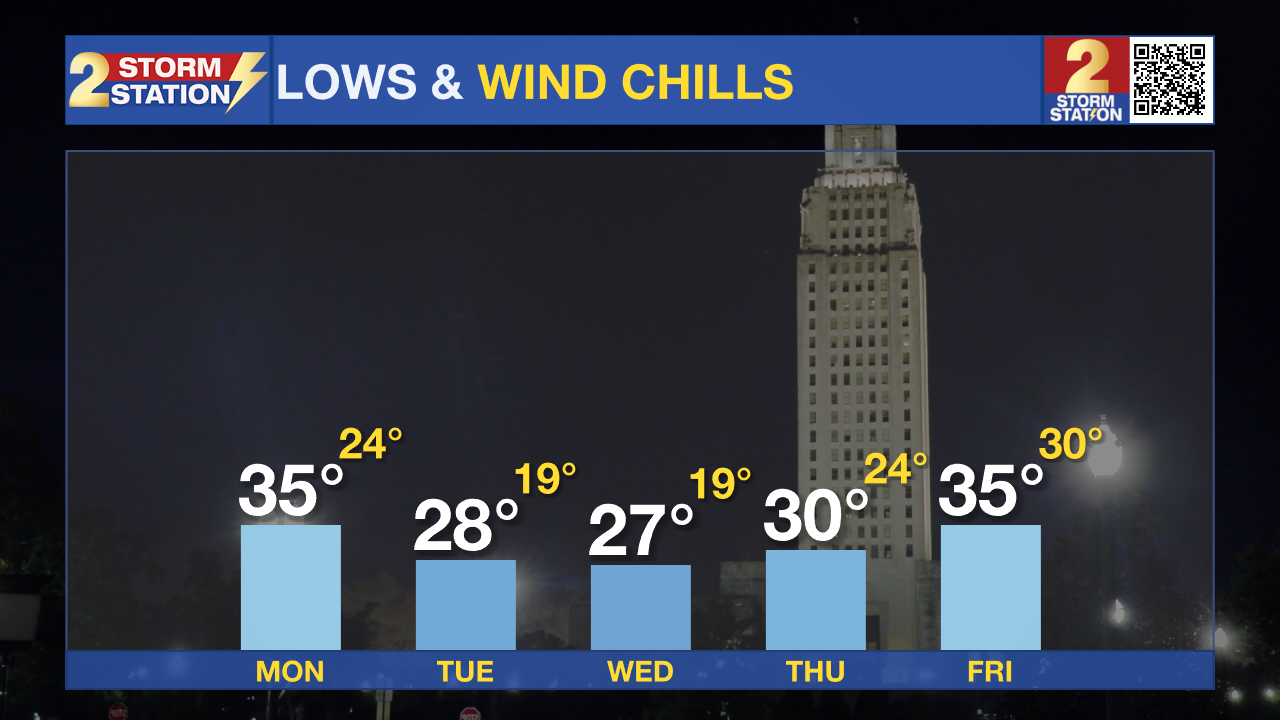
Arctic Blast Next Week: The cold front will clear the area by early Monday morning and deliver the coldest air of the Winter season so far. The Storm Station 7-Day Forecast shows several days where highs sit below 50° with lows in the 20s. Blustery conditions will lead to wind chills in the teens and 20s for several hours each night and morning. With a few temperatures below 27 degrees, it would be a good idea to wrap exposed, exterior piping prior to the cold arriving. It will be extremely cold as kids head back to school post-Christmas break, so don't forget to add many extra layers to their outfits as they head to the bus stop next week.
Trending News

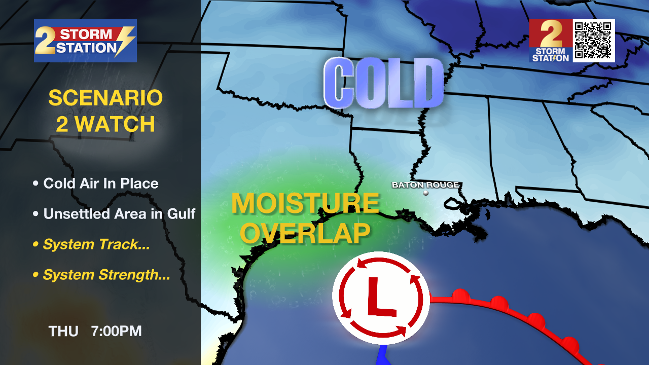
Looking at the tail end of the Storm Station 7-Day Forecast, there have been a few hints of frozen precipitation in the forecast guidance. Since the system that would create this weather is still well out in the Pacific Ocean, data on it is limited and so there are still a lot of unknowns. The bottom line is that if moisture can properly overlap with the coldest air, something more than cold rain could be possible late next week. Stay connected especially into next week as these details come into focus.
Get the latest 7-day forecast and real time weather updates HERE.
Watch live news HERE.
– Emma Kate C.
The Storm Station is here for you, on every platform. Your weather updates can be found on News 2, wbrz.com, and the WBRZ WX App on your Apple or Android device. Follow WBRZ Weather on Facebook and X for even more weather updates while you are on the go.


