

Latest Weather Blog
Thursday AM Forecast: Hanging on to some storms this morning, cold front passage later
Before a cold front gets here, we will observe some more showers and storms, especially along and south of the 10/12 corridor. After it passes through around midday, we get much drier, with humidity steadily dropping.
Today & Tonight: Heavy rain has been ongoing this morning down closer towards the coast. This will continue throughout the rest of the morning, and some of it could even spread further inland. Along and south of the 10/12 corridor will have the best chance of rain. A cold front will finally start pushing through around midday. This will render the 2nd half of the day much drier, with only some lingering showers. Highs will top out near 85 degrees under mostly cloudy skies. We will begin to clear out overnight with humidity steadily dropping. Lows will bottom out near 67 degrees.
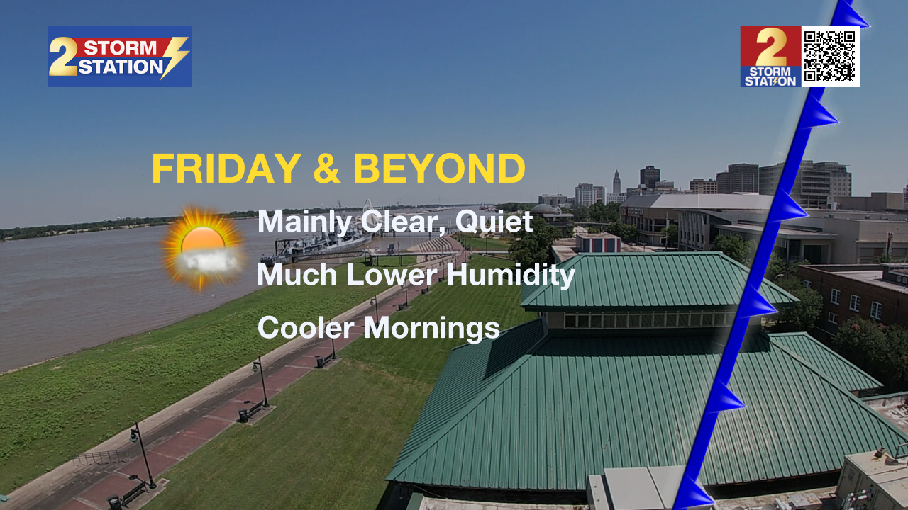
Up Next: Much nicer conditions are expected through the weekend and early next week. Friday will only feature a stray shower or two, and mostly sunny skies. Highs will top out in the mid-80s! Saturday morning is looking very nice, with lows near 63 degrees. Sunshine, highs in the upper 80s, lows in the mid-60s, and low humidity will dominate the forecast through Monday. Tuesday and Wednesday, expect a few more clouds, with temperatures working slightly higher. It might also start to feel a touch muggy, but overall humidity will not be too high.
Trending News
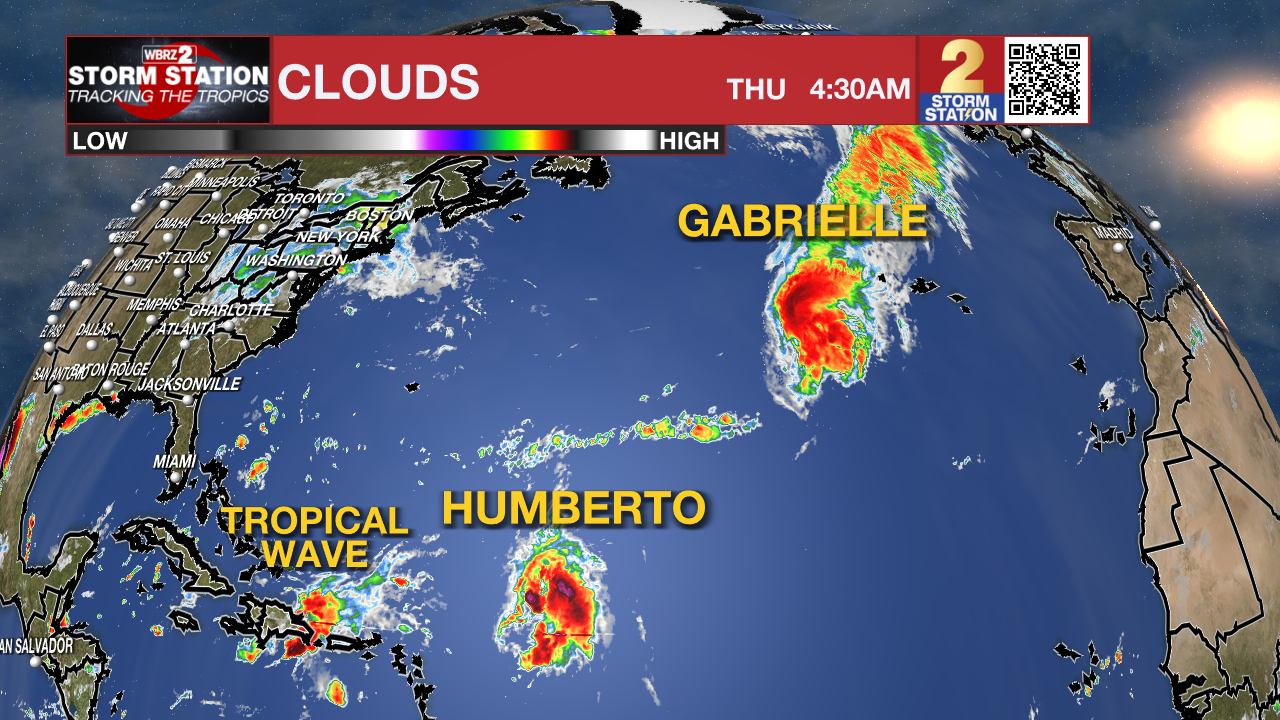
The Tropics: Gabrielle has moved over cooler waters, which is causing the storm to lose some strength, though its center is still well organized. Winds are estimated to be near 75 mph, and the storm is racing east at about 28 mph. Gabrielle is expected to pass near or over the Azores later today into early Friday, bringing a period of strong winds as it transitions into a different type of storm system. While it may weaken some over the next several hours, computer models suggest it could briefly strengthen again as it changes into an extratropical system, with hurricane-force winds possible as it crosses the Azores. After that, Gabrielle should gradually lose strength as it moves southeast toward Portugal, where it’s expected to dissipate in about four days.
Get the latest 7-day forecast and real-time weather updates HERE.
Watch live news HERE.
– Balin
The Storm Station is here for you, on every platform. Your weather updates can be found on News 2, wbrz.com, and the WBRZ WX App on your Apple or Android device. Follow WBRZ Weather on Facebook and X for even more weather updates while you are on the go.
More News
