

Latest Weather Blog
Thursday AM Forecast: Temperatures remain warm despite additional clouds and weekend rain
Showers and storms returning tomorrow will interrupt the quiet and seasonably warm week the Capital Area has had. Those with outdoor plans over the weekend will need to monitor the changing forecast.
Today & Tonight: After another mild start in the 60s, Thursday afternoon will remain above average with highs in the low to mid 80s around the region, even with the additional clouds around today. Winds will continue to usher in extra Gulf moisture as a light breeze between 5-15 mph kicks out of the southeast. A sprinkle or two may be felt over the next 24 hours but out next impactful rainmaker will not arrive until Friday afternoon. Look for lows overnight tonight in the 60s.
Up Next: A storm system brewing around south Texas early Thursday will slowly move towards Louisiana as we approach the weekend. Ahead of the rain, Friday will be mild and breezy with thicker clouds rolling in. Expect a few isolated storms during daytime hours on Friday, with an increase in coverage after nightfall. Latest data suggests this system may linger in to the day on Saturday as well. With an abundance of moisture in the atmosphere, any heavy downpours or prolonged rain storms could lead to poor drainage flooding.
Those with outdoor plans anytime between Friday afternoon and on Saturday, especially LSU Baseball, should monitor the forecast, and radar, closely. While the severe weather threat with this early weekend round of storms remains on the lower side, a rouge strong thunderstorm cannot be ruled out.
Once the rain begins to shut down on Saturday, the remainder of the weekend will be mostly dry. Look for highs on Saturday near 80 degrees and around 5° warmer on Sunday with highs in the mid-80s. While a mix of sun & clouds is to be expected on Sunday, a spotty thunderstorm or two may develop.
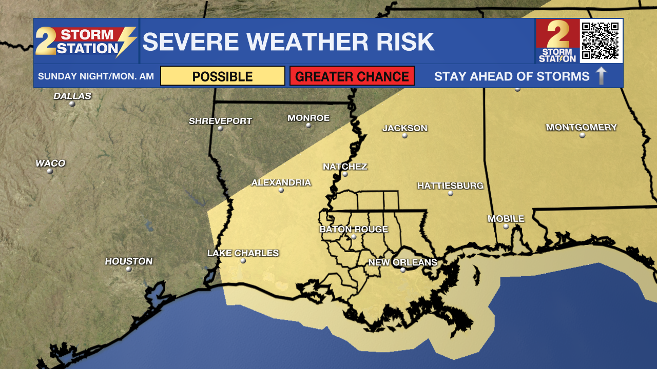
To end the weekend, a cold front will push into the region late Sunday into Monday and could produce a more organized round of showers and thunderstorms for the region.
Trending News
Even behind the Monday morning cold front, next week will see no cool down. Look for highs in the 80s through the start of April.
Get the latest 7-day forecast and real-time weather updates HERE.
Watch live news HERE.
– Emma Kate C.
The Storm Station is here for you, on every platform. Your weather updates can be found on News 2, wbrz.com, and the WBRZ WX App on your Apple or Android device. Follow WBRZ Weather on Facebook and X for even more weather updates while you are on the go.
More News
