

Latest Weather Blog
Thursday PM Forecast: much lower humidity, slightly cooler temperatures to move in
A stretch of pleasant weather is ahead for the Baton Rouge Area. A weak cold front is sliding through, ushering in much lower humidity and slightly cooler temperatures.
Tonight & Tomorrow: Tonight, skies will clear out and we’ll feel just a touch of cooler, drier air. That trend continues into Friday with afternoon highs topping out in the mid-80s, which is seasonable for late September. However, the lower humidity will make it feel much more comfortable.
Friday Night Blitz: For all the high school football games, conditions look close to perfect. Kickoff temperatures will be in the upper 70s, dropping into the upper 60s by the final whistles. No rain worries, no muggy air—just a crisp, pleasant evening under the lights. Fans may even want to bring some long sleeves for the ride home.
Saturday: Saturday will start off with some of the coolest temperatures so far this season as lows settle in the low 60s along and north of I-12. The afternoon will bring more sunshine and slightly warmer temperatures, with highs in the upper 80s.
Trending News
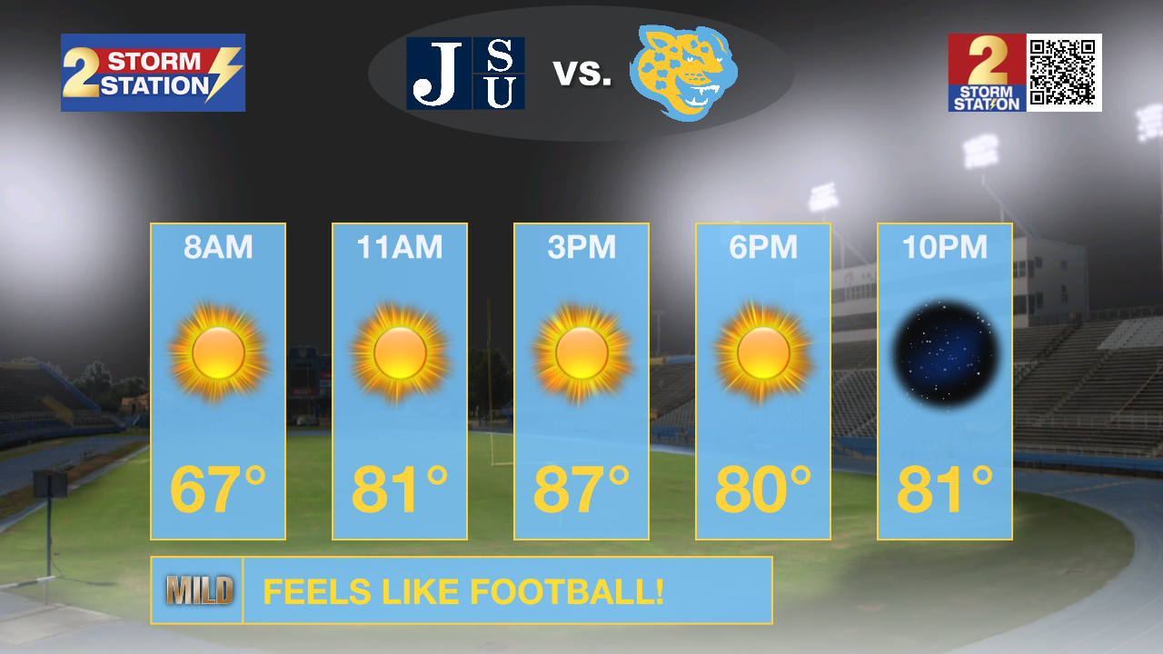
On The Bluff: Southern University’s home football game against Jackson State will play in mild, fall-like weather. Tailgaters can expect lots of sunshine with just a light breeze, and the afternoon will be warm but not uncomfortably hot.
Looking Ahead: Sunday through much of next week will be dominated by sunshine and only a few passing clouds. Highs will gradually climb back into the upper 80s and low 90s, but overnight lows will stay comfortable in the mid to upper 60s. Rain chances remain extremely low, with only a very slim 10% chance mid-to-late next week.
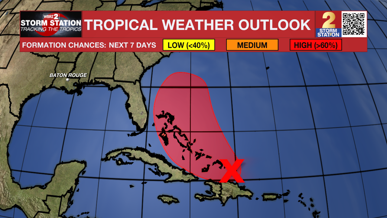
The Tropics: A tropical wave near Hispaniola and the Turks and Caicos is becoming more organized and is expected to form a tropical depression as it moves near the Bahamas late Friday or over the weekend. Heavy rain and gusty winds are likely in the Dominican Republic, Haiti, Turks and Caicos, and the Bahamas regardless of development. Forecast uncertainty remains high, but the risk of impacts along parts of the Southeast U.S. coast is increasing.
Tropical Storm Humberto is strengthening in the central Atlantic, currently carrying 50 mph winds as it moves northwest. Expect Humberto to become a hurricane within a day and possibly a major hurricane by the weekend. While it poses no immediate coastal threats, it will churn up rough seas across parts of the Atlantic.

Hurricane Gabrielle, packing 75 mph winds, is racing toward the Azores and will bring hurricane conditions, dangerous storm surge, and destructive waves tonight into early Friday. Rainfall of 3–5 inches could trigger flash flooding in the mountainous terrain. After moving through the islands, Gabrielle will weaken as it transitions into an extratropical storm while heading toward Portugal this weekend.
Get the latest 7-day forecast and real-time weather updates HERE.
Watch live news HERE.
– Josh
The Storm Station is here for you, on every platform. Your weather updates can be found on News 2, wbrz.com, and the WBRZ WX App on your Apple or Android device. Follow WBRZ Weather on Facebook and X for even more weather updates while you are on the go.
More News
