

Latest Weather Blog
Tuesday AM Forecast: Staying warm, but rain chances on the rise

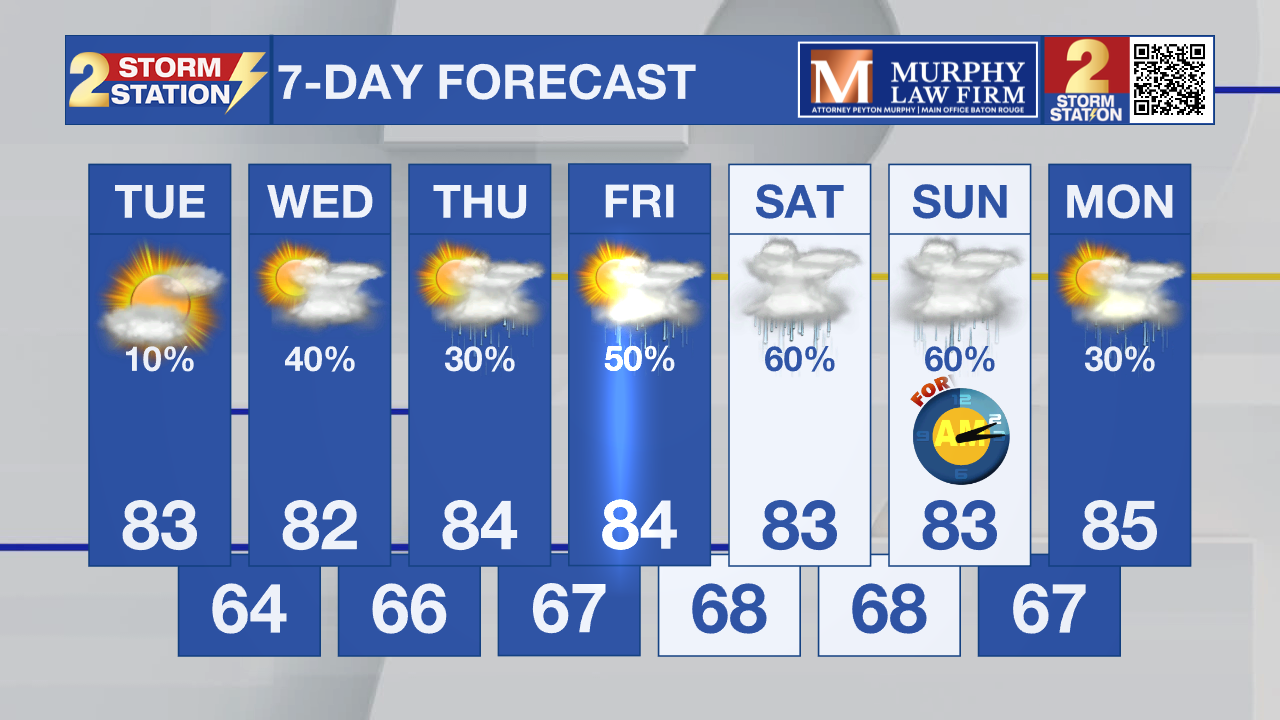
Up Next: That spring-like pattern isn’t backing down anytime soon. In fact, as moisture keeps building, it will help spark off daily opportunities for rain.
Rain Chances Increasing – Wednesday will feature isolated showers and a few thunderstorms as temperatures heat up through the day. Some heavier bursts of rain could impact both the lunch hour and the evening commute. Thursday appears to be the most “low-key” day, with about 30% of the Capital Area seeing a brief, nuisance-type shower. Heading into the weekend, rain coverage increases as deeper moisture settles in. Beginning Friday, more than half the area is likely to pick up rain each day. While widespread washouts aren’t anticipated, you’ll want to keep the umbrella handy. Overall, rainfall totals over the next week should average around an inch, with isolated higher amounts — not enough to erase drought concerns, but certainly helpful for lawns and gardens.
Temperatures Staying Warm – Afternoon highs in the 80s will stick around despite the uptick in rain chances. Overnight lows will also trend milder, with temperatures barely dipping into the mid-60s by the end of the week.
Morning Fog Concerns – Expect a familiar pattern of cloudy starts and partial afternoon sunshine. Some of those early clouds may produce pockets of dense fog, especially near rivers and lakes where warm, humid air passes over cooler water.
Trending News
Get the latest 7-day forecast and real-time weather updates HERE.
Watch live news HERE.
— Balin
The Storm Station is here for you, on every platform. Your weather updates can be found on News 2, wbrz.com, and the WBRZ WX App on your Apple or Android device. Follow WBRZ Weather on Facebook and X for even more weather updates while you are on the go.
More News
