

Latest Weather Blog
Wednesday AM Forecast: Rain moving out, cooler air working in
After a batch of widespread rain this morning, skies will clear for the rest of the day. Although another Arctic blast is not expected, lows will get back close to freezing to end the week.

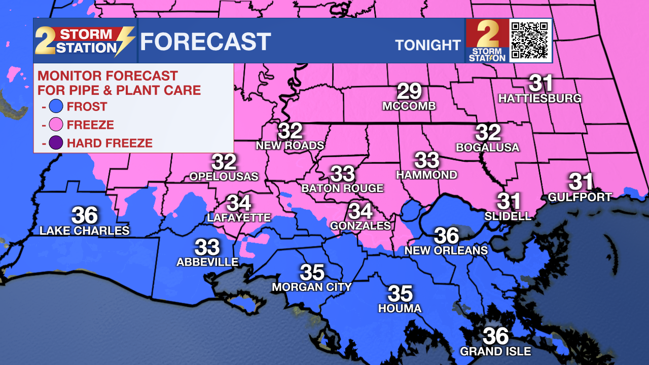
Today & Tonight: Rain will clear from west to east across the area this morning, with pretty much everyone dry by 6-7am. Skies will clear as well, especially in the afternoon and evening. Highs will be much cooler than yesterday, topping out in the mid to upper 50s. Cold air will work its way in overnight, but another Arctic plunge will not occur. Lows will get close to freezing, but hard freezes are not likely. This means pipes are ok this time around.
Trending News
Up Next: We will have one more morning in the 30s before a significant warmup begins. By Friday afternoon, highs will rise close to 70 degrees. Mardi Gras festivities are shaping up nicely weather-wise, with temperatures inching upward each day. Expect a prolonged stretch of calm, sunny conditions, with afternoon highs rebounding into the mid-70s by Sunday and Monday. All signs point to an ideal weekend for spending time outdoors and soaking it in.
Get the latest 7-day forecast and real-time weather updates HERE.
Watch live news HERE.
– Balin
The Storm Station is here for you, on every platform. Your weather updates can be found on News 2, wbrz.com, and the WBRZ WX App on your Apple or Android device. Follow WBRZ Weather on Facebook and X for even more weather updates while you are on the go.
More News
