

Latest Weather Blog
Wednesday PM Forecast: fire danger, a frosty morning and late weekend storms
A noticeable dip in temperatures late this week could lead to one frosty morning before a weekend warmup. While most of the weekend looks dry, the next rainmaker arrives late Sunday.
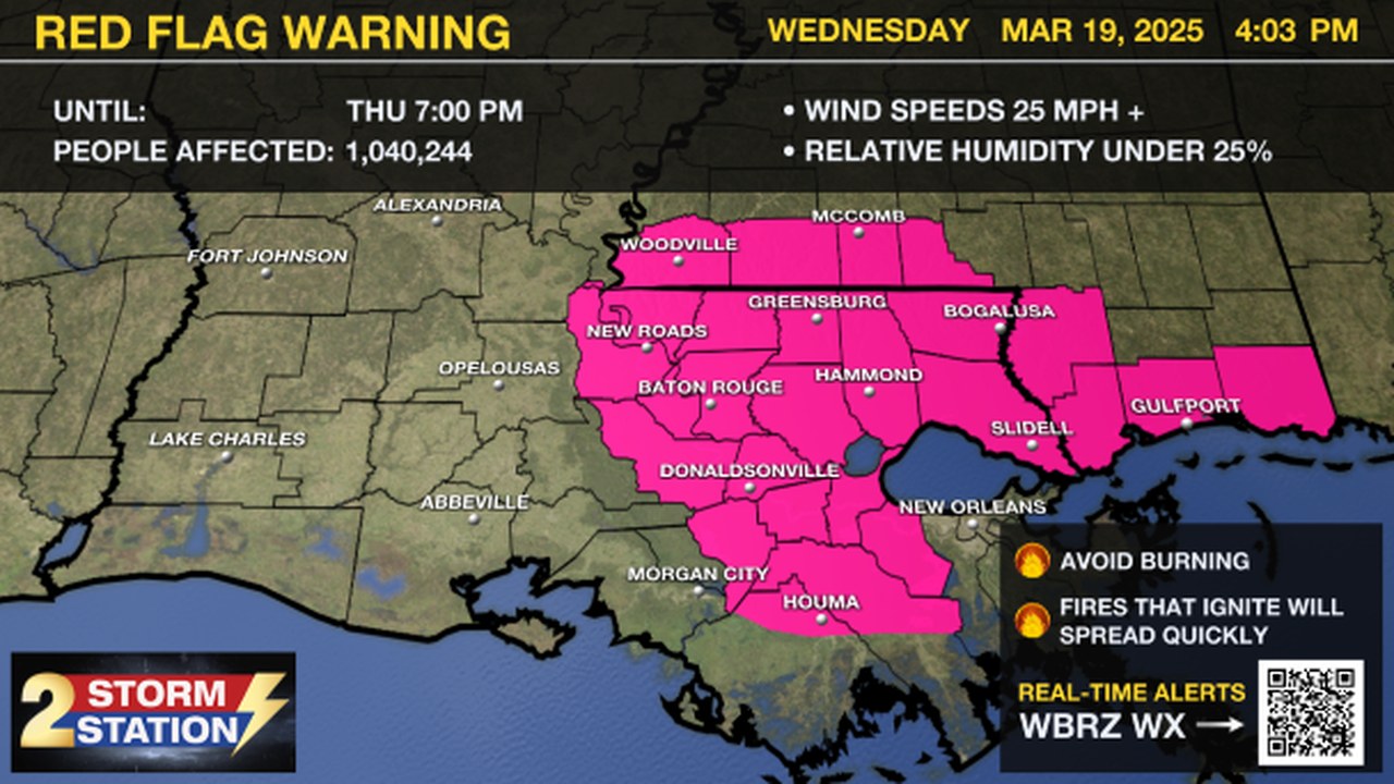
A RED FLAG WARNING is in effect Thursday from 9 AM to 7 PM for southeast Louisiana and southern Mississippi. Strong winds of 15-25 mph with gusts up to 30 mph and low humidity, as low as 20%, will create dangerous fire conditions.
Fires can start and spread quickly. Avoid outdoor burning—it’s not safe! Be extra cautious with anything that could spark a fire. Stay alert and help prevent wildfires!
Tonight & Tomorrow: Northwest winds at 10-15 mph will take over behind an early evening cold front passage. This will rapidly flush out any cloud cover and leftover showers. Cooler air will also pour into the region. Look for an overnight low in the mid to upper-40s. Sunshine will dominate from start to finish on Thursday. It will also be much cooler, with a high in the mid-60s. Wind will be noticeable; expect a northwest breeze at 10-20 mph with occasional gusts.
Trending News
Up Next: The chilliest air will be upon the Capital Area on Thursday night as lows dip into the 30s. With relaxing winds and sufficient moisture, areas of frost may develop. Tropical plants or new blooms may be threatened by frost on Friday morning, so take action to protect sensitive plants. Frost will not be an issue over the weekend as another warming trend begins. Plenty of sunshine and a return of southerly winds will boost temperatures into the weekend.
Sunday into Monday: A stronger frontal system will move across the region toward the end of the weekend. With more moisture present during this front's passage, a more significant round of rainfall is to be expected. While isolated showers and storms will be possible late Sunday, activity will likely peak overnight. Monday morning will need close monitoring for any possible impacts to the morning commute.
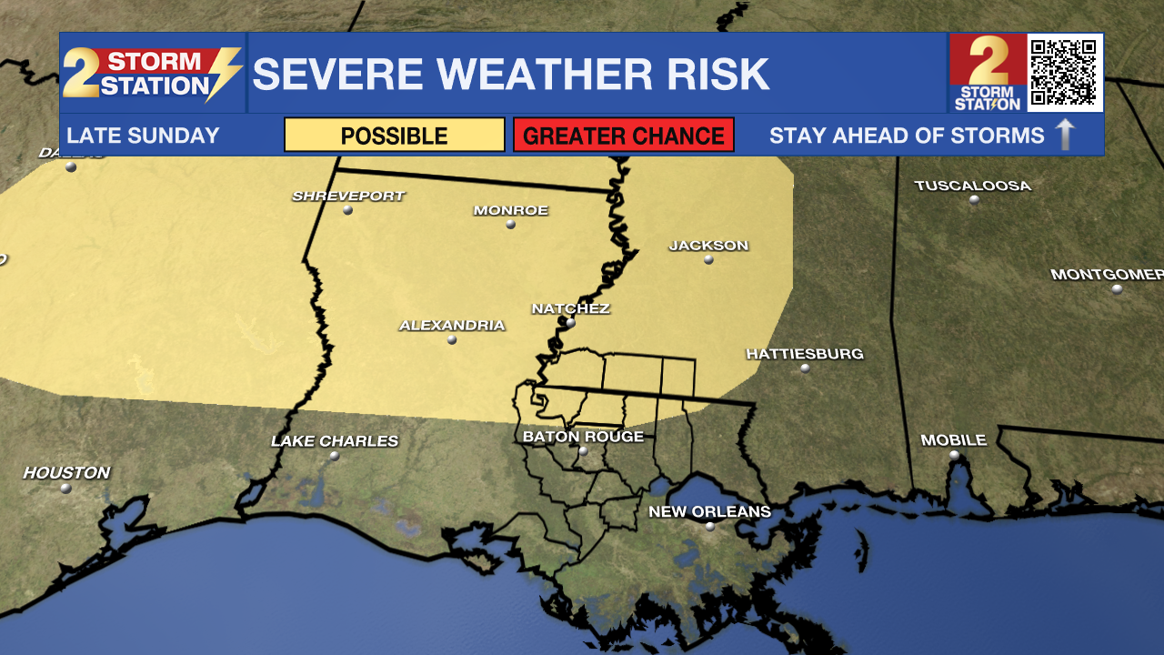
There appears to be an overlap in severe weather ingredients on Sunday in northern Louisiana, and that is where the Storm Prediction Center highlights a risk of severe weather. By the time storms make it to the Capital Area, the environment appears less favorable for major storms. A minor shift in the forecast could result in some changes to this, so stay in touch with the Storm Station as the weekend draws near.
Get the latest 7-day forecast and real-time weather updates HERE.
Watch live news HERE.
-- Meteorologist Malcolm Byron
The Storm Station is here for you, on every platform. Your weather updates can be found on News 2, wbrz.com, and the WBRZ WX App on your Apple or Android device. Follow WBRZ Weather on Facebook and X for even more weather updates while you are on the go.
More News
