

Latest Weather Blog
Wednesday PM Forecast: Storms rolling in during Mardi Gras weekend
With Wednesday's high of 82°, Baton Rouge surpassed the record high of 81° (2024, 2017, 1999). The rest of the workweek will remain warm and relatively calm. This leads into a not-so-quiet weekend as a more significant dose of rain and thunderstorms arrives.
Tonight: A weak cold front will kick up spotty showers through the evening. Rain will be hit-or-miss in nature, meaning that many will stay dry. As the front migrates toward the coast overnight, slightly drier air will fill in behind. This will limit fog production early Thursday along and north of the interstate system. South of I-10, where sufficient moisture will reside, patchy dense fog cannot be ruled out in the morning. Lows will vary, being a few degrees cooler to the north and milder to the south. Baton Rouge will land in the middle, waking up in the mid-50s.
Rest of the Week: Above-average temperatures will remain through Thursday and Friday. Thursday will be the cooler of the two days, with a high in the mid to upper-70s. Friday could see highs flirting with 80° again. Both days will feature a mixture of clouds and sun. Don’t expect much rain, aside from a stray shower or two. The forecast cooperates with the LSU Baseball season opener on Friday afternoon. The weekend games, however, might be a different story.
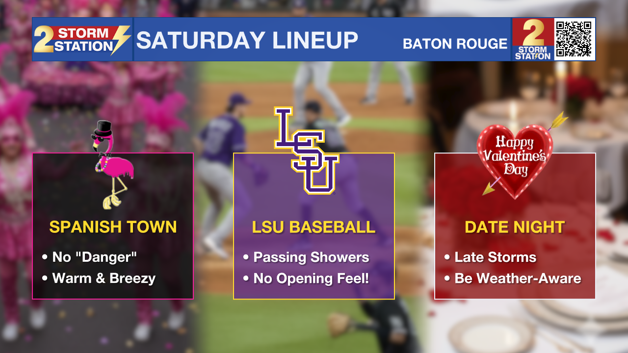
Saturday: Between Valentine’s Day dates, the Spanish Town Mardi Gras Parade, and LSU Baseball’s opening weekend against Milwaukee, there will be a lot happening outdoors. An active weather pattern will accompany the busy calendar. Developing showers during the day will be followed by arriving storms at night. Confidence is growing that storms will arrive after dark.
The Spanish Town Parade – For the downtown parade-goers, the midday timeframe looks cooperative with mostly cloudy skies and a few breaks of sun. Passing showers will be possible, but the stronger thunderstorms will wait until later. Even lightning may be hard to come by, which bodes well from a safety perspective. The warm temperatures will continue with temperatures in the mid-to-upper 70s, and south winds of 10-20 mph could make it a little tough to catch and hold throws!
LSU Baseball – Expect a muggy and breezy afternoon at Alex Box Stadium without the typical opening weekend feel. During the game, afternoon highs near 80° will be met. Some sun may sneak through mostly cloudy skies, and a passing shower is possible, but there should be enough time to complete the game before heavy action arrives during the evening.
Trending News
Date Night – More significant weather will occur during the evening and possibly overnight hours. A line of storms will be approaching from the west and arrive late Saturday. While too early to pin down the exact time, be weather-aware through the evening while enjoying Valentine’s Day. While not a "slam dunk" severe weathe setup, a few storms could be strong, so have a way to receive alerts while out and about. There’s even a chance that the strongest storms come after bedtime. Download the Storm Station Weather App HERE.

Sunday & Beyond: Expect lingering clouds with partial clearing from time to time on Sunday. Keep an umbrella handy, as there might be a few leftover showers. Look for a high near 70° on Sunday. Lundi Gras will start mild near 50° before climbing into the lower and middle 70s. Laissez les bons temps rouler on Mardi Gras — dry conditions will prevail with highs in the mid-70s.
Get the latest 7-day forecast and real-time weather updates HERE.
Watch live news HERE.
— Meteorologist Malcolm Byron
The Storm Station is here for you, on every platform. Your weather updates can be found on News 2, wbrz.com, and the WBRZ WX App on your Apple or Android device. Follow WBRZ Weather on Facebook and X for even more weather updates while you are on the go.
More News
