

Latest Weather Blog
Friday evening video forecast
Related Story
Getting close to light jacket territory the next few mornings thanks to a cold front passage! Might have to knock the dust off those jackets as it has been a while since you used them.
Tonight & Tomorrow: Drier air will continue to push into the area overnight. This will allow lows to slip into the mid to lower 60s. This is borderline light jacket territory! Saturday is looking great for any outdoor plans or activities. Sunshine will dominate all day long, with highs topping out in the upper 80s. Dry air will keep rain chances near zero, and humidity low.
Up Next: Quiet and pleasant weather will continue into early next week. Highs will stay in the upper 80s, lows in the low to mid-60s, with little to no humidity. Atmospheric moisture will begin to slowly rise starting Tuesday. Lows will begin to come up a few degrees, and it will also start to feel a touch muggy. Rain chances through the end of the week will remain rather low, but a stray shower is not out of the question.
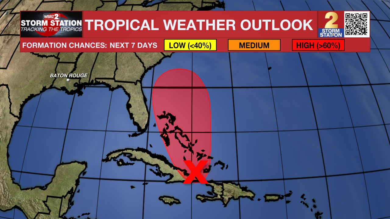
The Tropics: A low-pressure system is forming near eastern Cuba and the southeastern Bahamas. Conditions are favorable for this system to strengthen into a tropical depression within the next day or so as it moves northwest or north across the Bahamas. Heavy rain and strong winds are already affecting the Dominican Republic, Haiti, the Turks and Caicos, the southeastern Bahamas, and eastern Cuba, and will likely spread to the rest of the Bahamas over the weekend. Tropical storm watches or warnings may be issued later today, and while the exact path and strength remain uncertain, parts of the southeast U.S. coast could face wind, rain, and storm surge impacts early next week. Residents in the Bahamas and along the southeast U.S. coast should stay alert and closely monitor updates.
Humberto is rapidly strengthening, with satellite images now showing a clear eye and powerful thunderstorms wrapping around its center. Winds have increased to around 90 mph, and conditions suggest the storm will continue to intensify quickly, with a high chance of becoming much stronger over the next day. Forecasts show Humberto could strengthen significantly through the weekend before encountering stronger winds aloft that may cause some weakening early next week. As the storm moves slowly northwest now, it is expected to curve north and then northeast into the open Atlantic, passing near Bermuda in about 4–5 days. While models agree on this track, Humberto’s wind field is likely to grow larger as it turns.

Get the latest 7-day forecast and real-time weather updates HERE.
Watch live news HERE.
– Balin
The Storm Station is here for you, on every platform. Your weather updates can be found on News 2, wbrz.com, and the WBRZ WX App on your Apple or Android device. Follow WBRZ Weather on Facebook and X for even more weather updates while you are on the go.
News
