Monday Midday Video Forecast
Related Story
After a decent amount of rain over the weekend, conditions have quieted down just in time for Labor Day. Any outdoor activities will be mainly dry but in result, hot! This week will feature many weather pattern shifts, the first being more rain by midweek.
Today & Tonight: While a few pop-up storms are possible during afternoon hours, overall the Capital Area will remain mainly dry for any Labor Day outdoor activities on Monday. In return for the drier conditions, it will be a hot day. Afternoon high temperatures will climb into the middle-90's with heat index values topping out between 105-107°, just below Heat Advisory criteria. Expect mainly sunny skies all morning with a few fair weather cumulus clouds puffing up during afternoon hours. Overnight, skies will become mostly clear with temperatures dropping back into the middle 70's around the state.
Up Next: Tuesday will be extremely similar to the start of the week, with mild morning conditions and a hot afternoon. Mostly sunny conditions during sunrise Tuesday will become mostly cloudy by sunset and clouds move in with an increase of deep tropical moisture during the day. Only a few isolated showers and storms will develop Tuesday afternoon around the Capital Area.
By mid-week, deep tropical moisture will engulf the state, bringing back promising rain coverage on Wednesday and Thursday. Both days may be a bit dreary with numerous showers and thunderstorms and overcast skies when not raining. The deep moisture content in the atmosphere could allow for 2-3" of rainfall in the 48 hour time period, raising a concern for flash flooding, especially in poor drainage areas. The Storm Station will continue to monitor this threat, while low right now, over the next few days
The big changes don't stop at midweek. Friday will mark a transition from a soggy pattern to one that's just about bone dry. Confidence is growing that this change will be accompanied by a cold front. Should this front pass, it would result in lower humidity, cool mornings, and dry conditions for the weekend. This would be ideal for the LSU football home opener. Be advised that this is still many days away, and future adjustments might be needed. But it's a promising signal - stay tuned!
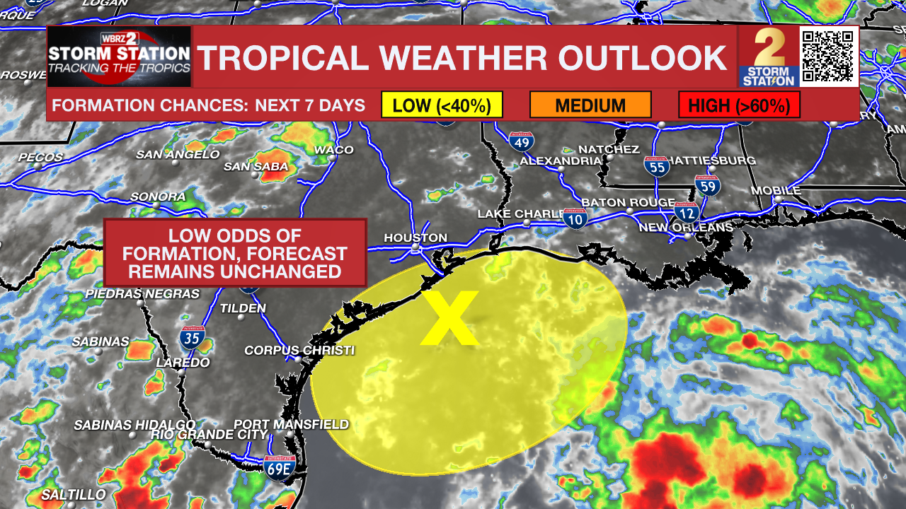
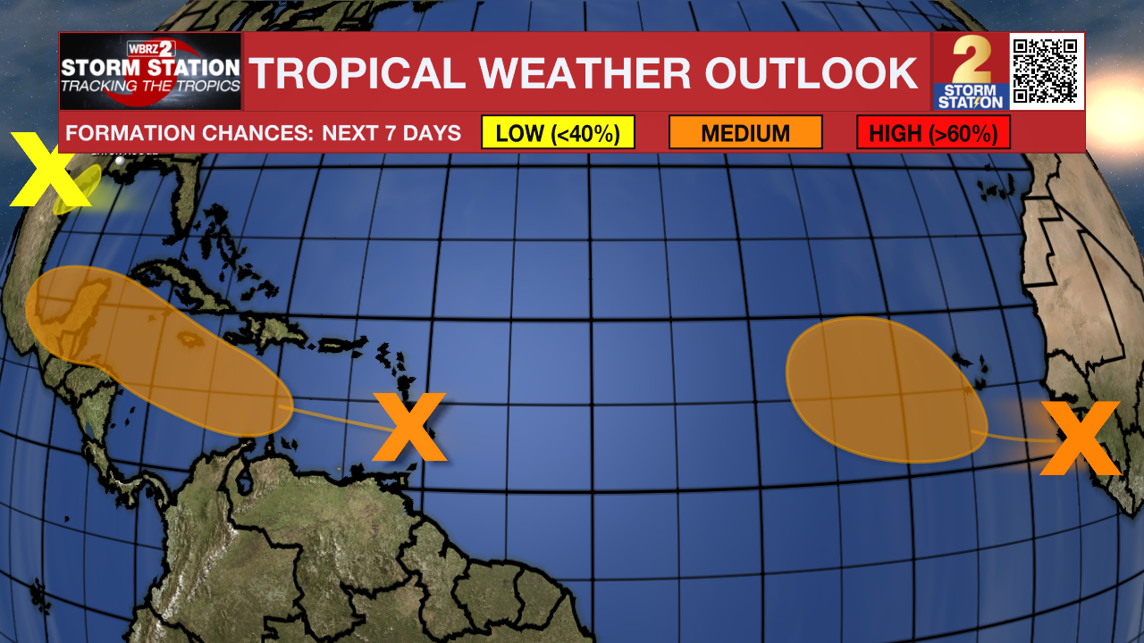
The Tropics: A disorganized area of low pressure just offshore the upper Texas coast continues to produce a few areas of storm activity near the TX/LA coasts. While this system is in close proximity to Louisiana, overall impacts will be low regardless of development. In other words, the Storm Station forecast (above) will not change even if the system becomes tropical in nature. This system will meander along the coast in the coming days. During this time, development odds appear low.

Two other tropical waves, one located a few hundred miles east of the Lesser Antilles and the other further east in the Atlantic require closer monitoring in the coming days. Both of these disturbances hold a medium (40%) chance of taking on tropical characteristics in the next 7 days.

The system closest to the Caribbean could become a tropical depression later this week, but that is far from a guarantee. If it can happen, there is a change the storm moves into the Gulf of Mexico. However, it is still too far out to know anything about the long-term prospects of this system, including final strength or location. Stay in touch with the Storm Station as new data continues to pour in.
Get the latest 7-day forecast and real time weather updates HERE.
Watch live news HERE.
-Emma Kate C.
The Storm Station is here for you, on every platform. Your weather updates can be found on News 2, wbrz.com, and the WBRZ WX App on your Apple or Android device. Follow WBRZ Weather on Facebook and Twitter for even more weather updates while you are on the go.


