Sunday Night Video Forecast
Related Story
A cold front has finally swept through the Capital Area, ending the severe weather threat and pushing the rain out. But the passage of this front has also opened up the freezer door. The coldest air of the season so far is now upon us.
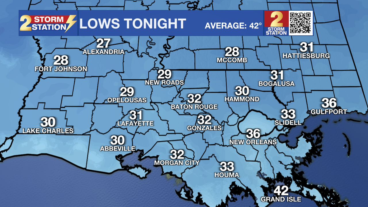
Rest of Tonight: Rain will quickly come to an end behind a strong cold front. Now, the primary focus is shifting to cold weather. Temperatures will rapidly fall overnight, with morning lows near freezing in Baton Rouge. Rural communities surrounding Baton Rouge and areas north of the interstate could dip into the upper-20s.

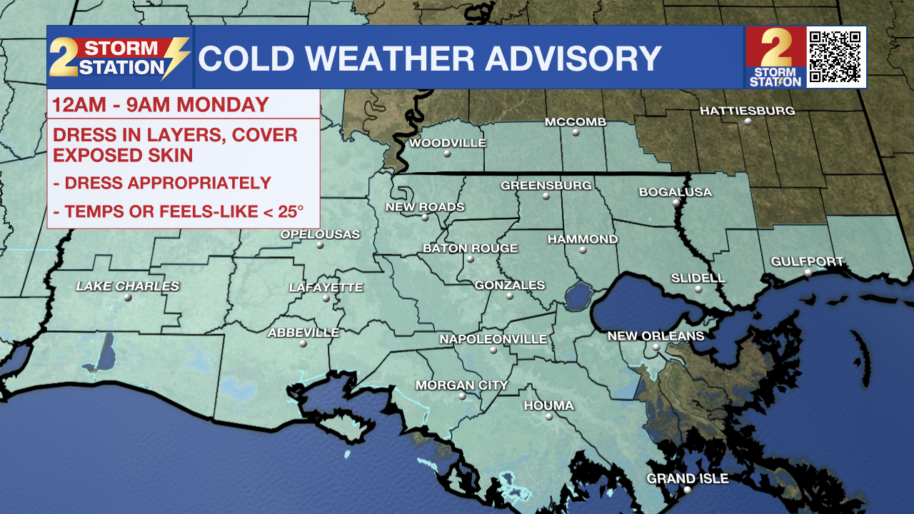
The cold front will not be successful in getting rid of wind. Although wind speeds should come down a tad overnight, but it will still be blustery at dawn. Morning wind chills will be below 25° just about everywhere, with areas north of Baton Rouge experiencing feels-like temperatures in the teens. To account for this, A COLD WEATHER ADVISORY will be in effect from midnight to 9 a.m. Monday. Pets will require warm shelter, and those leaving for work or school in the morning need extra layers. Also be sure to protect your plants from the cold. It's not a bad idea to go ahead and wrap pipes either, as even colder morning temperatures are possible in the following nights. That is especially the case north of I-10/12.

As a reminder, starting this season, the National Weather Service has changed the cold weather alerts. You will receive different messages to highlight impacts than during previous winters. Review those changes, including the removal of Hard Freeze Warnings, HERE.
Monday: In spite of a mainly sunny sky, expect a cold and blustery day with a high temperature in the mid-40s. Factor in a northwest breeze at 10-20 mph, and afternoon wind chills will struggle to surpass 40°. Layers will be needed during the day also.
Up Next: The rest of the week will feature the same cold mornings and chilly afternoons. Tuesday and Wednesday morning's lows might dip into the 20s. Some communities could face their first hard freeze of the season. Prepare your homes by wrapping exposed, exterior piping prior to the cold arriving.
Looking toward the end of the Storm Station 7-Day Forecast, there have been subtle hints of frozen precipitation in the forecast guidance. Since the system that would create this weather is still over the Pacific, data on it is limited and that results in some unknowns. For what it's worth, much of the data is trending toward a cold rain in the Thursday-Friday timeframe. Nevertheless, if things can shift in a manner where moisture properly overlaps with the coldest air, something more than cold rain could be possible. That system will move onshore in the western U.S. early Monday, and the forecast should begin coming into focus in the next 24-36 hours. Stay connected especially into next week as these details come into alignment.
Get the latest 7-day forecast and real time weather updates HERE.
Watch live news HERE.
-- Meteorologist Malcolm Byron
The Storm Station is here for you, on every platform. Your weather updates can be found on News 2, wbrz.com, and the WBRZ WX App on your Apple or Android device. Follow WBRZ Weather on Facebook and X for even more weather updates while you are on the go.


