

Latest Weather Blog
Thursday Evening Video Forecast
Related Story
It will be a soggy end to the workweek across the Capital Area, as a very moisture-rich atmosphere—thanks to an easterly wave and a weak surface low near the Chandeleur and Breton Sounds—will keep rain chances high. Big heat will come back before the weekend is over.
Tonight & Tomorrow: Expect the number of showers and thunderstorms to wane into the evening hours, though a spotty shower will remain possible. Otherwise, skies will be mostly cloudy with lows in the mid 70s. Friday will be the second consecutive day with numerous showers and thunderstorms. Activity could get started a little earlier, too. With so much tropical moisture in the air, any storm could dump heavy rain, but quick movement from east to west should help keep flood risk on the lower end. Aside from that, added cloud cover will likely keep temperatures a bit cooler, topping out in the upper 80s for most.
Up Next: The weekend will start unsettled but trend drier. Saturday will still feature scattered showers and thunderstorms, especially in the afternoon, but a building upper-level ridge will begin to flex its muscle after that. Sunday and into early next week, rain coverage will drastically decrease, and temperatures will climb. Sunday through Tuesday will be hot and humid with highs in the mid to upper 90s and feels like temperatures over 105 degrees, possibly returning the need for heat alerts. Minimal relief is expected at night as lows stop in the mid to upper 70s. Any showers and thunderstorms will be spotty, at best.
By Wednesday, that ridge will shift west again, opening the door for another round of moisture and increased rain chances. That should help bring temperatures back closer to seasonal norms in the mid-90s.
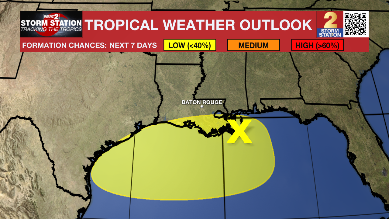
The Tropics: A broad area of low pressure over the north-central Gulf is currently producing an area of disorganized showers and thunderstorms. Over the next day or so, this system is forecast to move generally westward across the northern Gulf where some slow development is possible. By this weekend, the system is likely to move inland, ending its chances for development. Regardless of tropical cyclone formation, locally heavy rainfall is possible for portions of the northern Gulf coast through this weekend.
Get the latest 7-day forecast and real-time weather updates HERE.
Watch live news HERE.
– Josh
The Storm Station is here for you, on every platform. Your weather updates can be found on News 2, wbrz.com, and the WBRZ WX App on your Apple or Android device. Follow WBRZ Weather on Facebook and X for even more weather updates while you are on the go.
News
