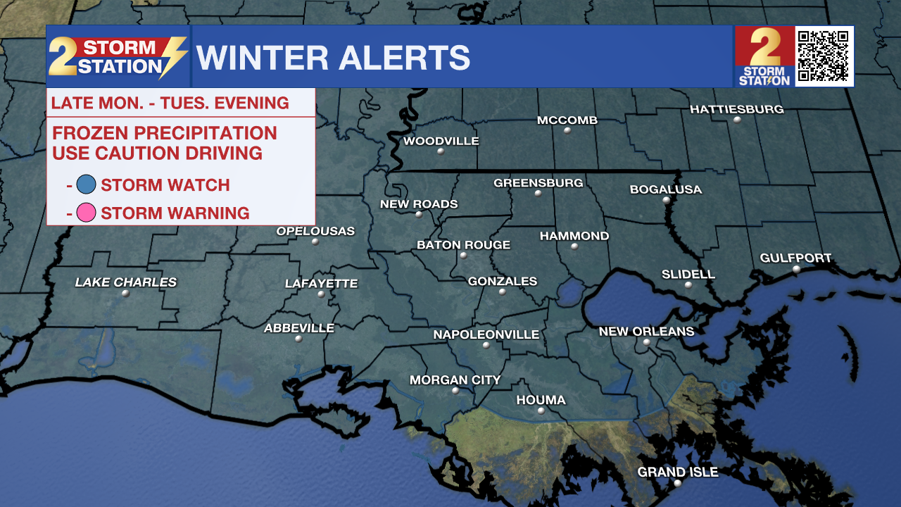
Confidence in frozen precipitation event continues to increase
A *WINTER STORM WATCH* has been issued for the entire viewing area from late Monday through Tuesday evening. Heavy snowfall is possible over the central and northern half of the area, with heavy mixed precipitation possible over the southern half of the area. Snow accumulations between between 3 to 6 inches along and north of the Interstate 10/12 corridor will be possible, with 1 to 3 inches south of this line. Snow accumulations might be limited in some areas (especially south) due to the presence of mixed precipitation. Ice accumulations less than 1/4 inch north and around a 1/4 inch south possible. Just like with rainfall, there may be isolated higher amounts. Accumulations are still subject to change.

Use the weekend to make final preparations for dangerous cold ensuring people and pets will have access to warmth and pipes are wrapped. Monitor the forecast for updates on the possibility of snow, sleet and freezing rain next week.
Today & Tonight: Although some locations saw some clouds to start the morning, almost all of these clouds will dissipate by the afternoon. Sunday will overall be pretty chilly, with highs topping out in the upper 40s. Winds will be breezy out of the north at 10-20 mph. Overall, these will not be the greatest conditions for half and full marathon contestants in the Louisiana Marathon. Now is the time to prep for the cold. Temperatures will rapidly fall in the overnight hours. Lows will be near 24 degrees under mainly clear skies. Winds will not calm much, meaning wind chills could reach the mid to lower teens at times. These are dangerous values, so make sure to cover exposed skin if outside.
Arctic Blast: Lows will stay in the 20s all of next week with multiple hard freezes expected. Some locations could even drop into the teens. At these temperatures, exposed, outdoor pipes could rupture if not wrapped. In addition to that, a slow drip of inside faucets overnight could also help in preventing damage. Especially at night, wind chills or feels-like temperatures will be dangerously low, as low as the low teens at times only recovering into the 20s and 30s by day. Highs will be in the 40s most afternoons, but wintry precipitation could result in even colder highs on Tuesday
The potential “main event” of this Arctic Blast will be with a storm system on Tuesday. This system is expected to move generally west to east across the Gulf of Mexico sending a plume of moisture across the frigid air mass. The signal, or likelihood, for snow has increased even more. The Storm Station places about a 70-90% chance of measurable snow across the Capital Area. Subtle changes in track are still possible and could alter the forecast. Closer towards the coast, locations might expect to see plain rain while others could see a mix of ice, sleet, and snow. Expect fine tuning of those details, including timing and amounts by location in the next few days.
Trending News

Be sure to watch for updates from the Storm Station, especially over the weekend as things come into focus. Also, make sure to have a way to receive weather alerts, as many regarding the incoming cold temperatures and wintry weather will likely be issued in the coming days.
Get the latest 7-day forecast and real time weather updates HERE.
Watch live news HERE.
– The Storm Station Meteorologists
The Storm Station is here for you, on every platform. Your weather updates can be found on News 2, wbrz.com, and the WBRZ WX App on your Apple or Android device. Follow WBRZ Weather on Facebook and X for even more weather updates while you are on the go.


