

Latest Weather Blog
Friday AM Forecast: Showers & storms likely the next few days
Storms will stay likely in the PM hours the next few days. Heavy rain and lightning could impact the Friday evening commute, and tailgaters on Saturday.
.png)
Today & Tonight: Heads up for your Friday as another wave of numerous rain and storms is expected, with heavy downpours likely in some spots. If you're heading home along the I-10 or I-12 corridors Friday evening, use caution as water could quickly pool on roads in low-lying and poor-drainage areas. On the bright side, extra clouds and rain will keep us a bit cooler, capping high temperatures in the upper 80s to low 90s. Things will quiet down overnight as storm activity fades, leaving us with muggy lows in the mid-70s.
Trending News

Use the slider to advance through the next 24 hours of Futurecast
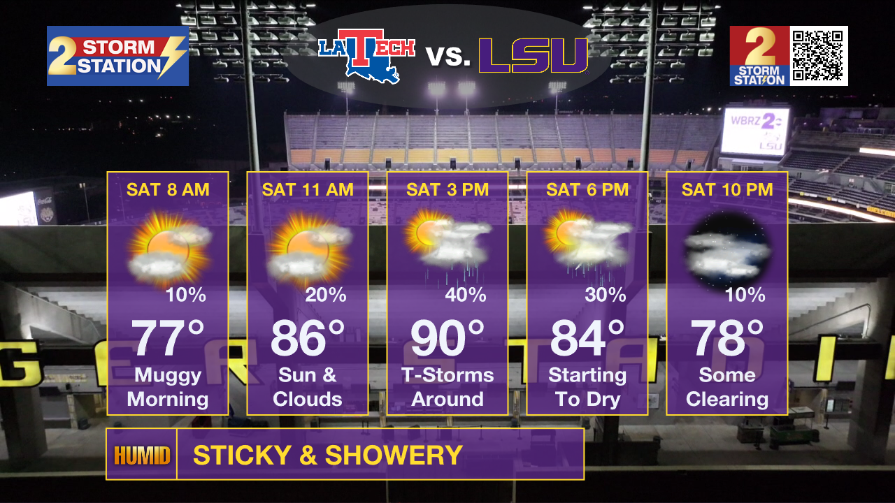
Football Forecasts: Keep your weekend plans for high school and college football, but also keep a watchful eye to the skies. A complete washout is not expected for Friday night or Saturday, though any nearby lightning could force temporary game delays. For high school matchups on Friday night, lingering storms will taper off through the evening as temperatures slip out of the 80s into the upper 70s. Over in Tiger Stadium on Saturday, expect partly sunny skies with highs reaching the low 90s. Passing showers and storms are possible from late morning right up to kickoff, but you will still find plenty of dry time to enjoy your tailgating.
Up Next: Shower and storm coverage will begin to decrease for the 2nd half of the weekend. As a ridge of high pressure builds, storms will have a harder time developing, setting the stage for high temperatures to climb back into the mid-90s by Monday. Combined with humidity, feels-like temperatures could surpass 108 degrees, so additional heat advisories are certainly not off the table just yet. Fortunately, these hot conditions look brief, as long-range models show a couple of cold fronts attempting to slide into the region by next weekend. While it is still too early to guarantee direct impacts or a sharp cool-down, it is a promising hint that late-summer heat will soon lose its grip.
Get the latest 7-day forecast and real-time weather updates HERE.
Watch live news HERE.
The Tropics: The tropics are quiet near the peak of hurricane season. No development is expected anywhere across the Atlantic, Caribbean, or Gulf over the next 7 days. In fact, only two years in modern history (since 1950) have featured no active storms five days on either side of September 10—1992 and 2025. This season will likely mark a third. In addition, no season in modern history has gone past September 11 without the first hurricane developing. That record will soon belong to 2026.
– Balin
The Storm Station is here for you, on every platform. Your weather updates can be found on News 2, wbrz.com, and the WBRZ WX App on your Apple or Android device. Follow WBRZ Weather on Facebook and X for even more weather updates while you are on the go.
More News

