

Latest Weather Blog
Saturday AM Forecast: Next front set to deliver a few showers and big-time cooldown
The warm, quiet pattern will persist through much of the weekend before an early-week cold front comes to shape things up. Not only will it bring a chance for showers and storms from late Sunday through Monday, but much colder air will also take over by Thanksgiving.
Today & Tonight: Saturday will bring more sunshine, and perhaps even more so as the atmosphere dries out a bit. This will warm temperatures up nicely for the afternoon, with highs reaching the upper 70s and lower 80s. The weather will cooperate for any outdoor plans.
Mostly clear skies and calming winds this evening will send temperatures tumbling through the 60s. As lows bottom out in the upper 50s toward dawn, patchy fog may develop across the region. Keep that in mind if you're traveling ahead of the holiday or heading out to an early morning church service. When driving through fog, be sure to use your low beams and leave extra following distance, as visibility can drop quickly.

Up Next: Though Sunday may start off with some fog in spots, the sun will peek out after daybreak. More clouds will mix in as the day progresses in response to an approaching cold front from the northwest. With that front now appearing to arrive on Monday, that would keep Sunday largely dry aside from a few sprinkles here and there. Clouds will increase Sunday night as the front approaches, bringing a chance for isolated rain late. Isolated showers will remain possible on Monday, along with a few thunderstorms if storms can tap into enough daytime warmth. Such storms might also support occasional small hail.
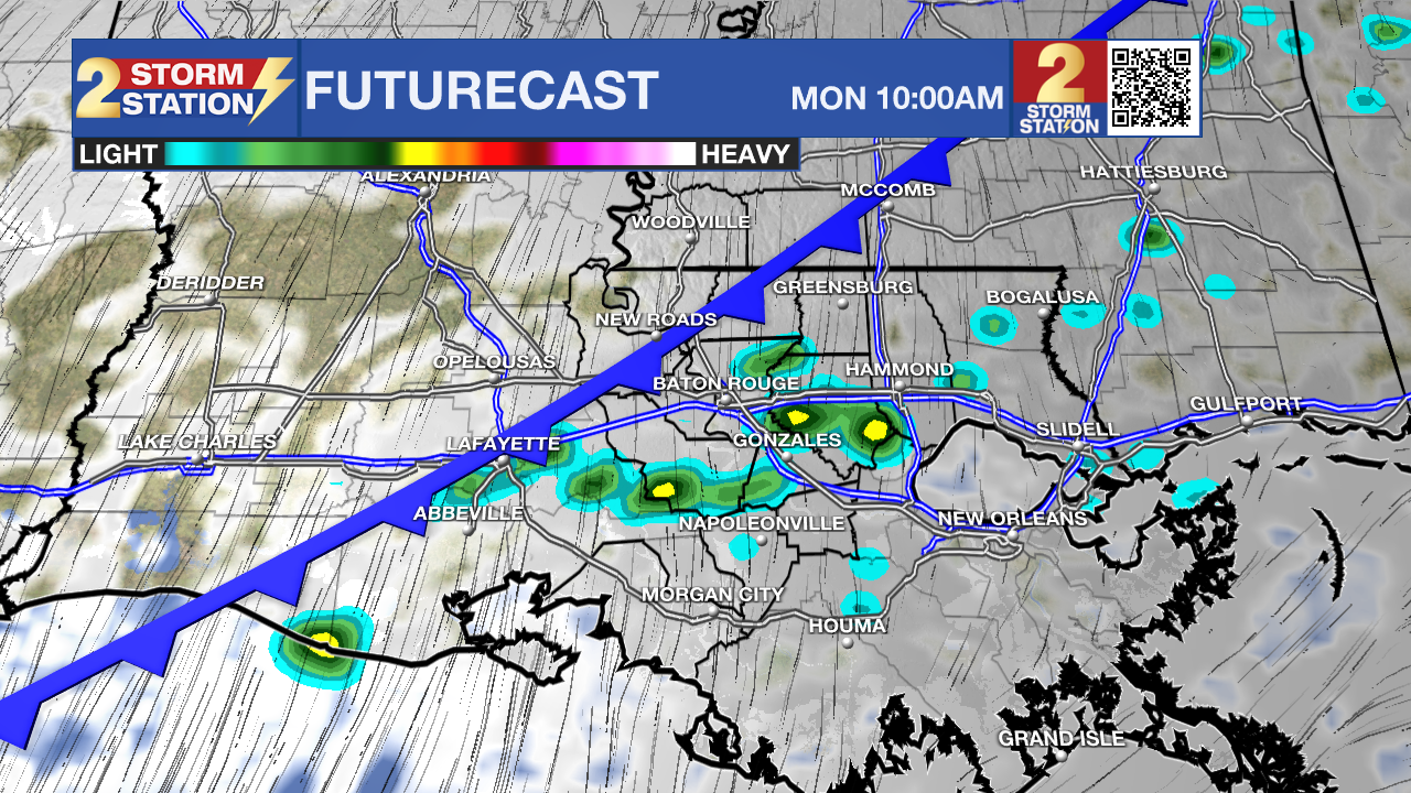
Moving Into Thanksgiving: As the front marches eastward, expect a steady cooldown leading into Thanksgiving. Highs will drop through the 60s next week, dipping into the low 60s by the end of the week. Mornings will turn cold, with lows settling into the upper 30s by Thanksgiving. Anyone planning to hit the Black Friday sales early will definitely want to bundle up.
Trending News
Get the latest 7-day forecast and real-time weather updates HERE.
Watch live news HERE.
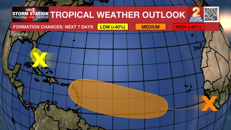
The Tropics: A large, non-tropical area of low pressure is positioned off the east coast of Florida. Though the system had promise of acquiring tropical or subtropical characteristics in recent days, those chances are decreasing. Nevertheless, the storm system will still produce gusty winds, dangerous surf, rip currents, and coastal flooding to parts of the Southeast and Mid-Atlantic coasts into early next week. Heavy rain and the threat of flash flooding will also be an issue over the coastal Carolinas and Mid-Atlantic.
— Meteorologist Malcolm Byron
The Storm Station is here for you, on every platform. Your weather updates can be found on News 2, wbrz.com, and the WBRZ WX App on your Apple or Android device. Follow WBRZ Weather on Facebook and X for even more weather updates while you are on the go.
More News

