

Latest Weather Blog
Friday PM Forecast: front to deliver passing showers, then much lower humidity
A strong cold front sliding in from the north will bring a much-needed break from the humidity and even deliver the coolest mornings we’ve seen since early June. Before that, there will be some humidity to contend with and showers to dodge this weekend.
Tonight & Tomorrow: Mostly cloudy skies will persist through the night. It is possible that a light shower or some sprinkles could fall, but precipitation is unlikely for most. Lows will remain in the mid-70s thanks to the clouds and increasing moisture in the air. Saturday will still feel like summer. Highs will reach into the low 90s with ongoing humidity. A cold front will push in from the north during the afternoon hours, possibly triggering isolated showers and thunderstorms – keyword isolated – with only 30% of the Capital Area getting any rain.
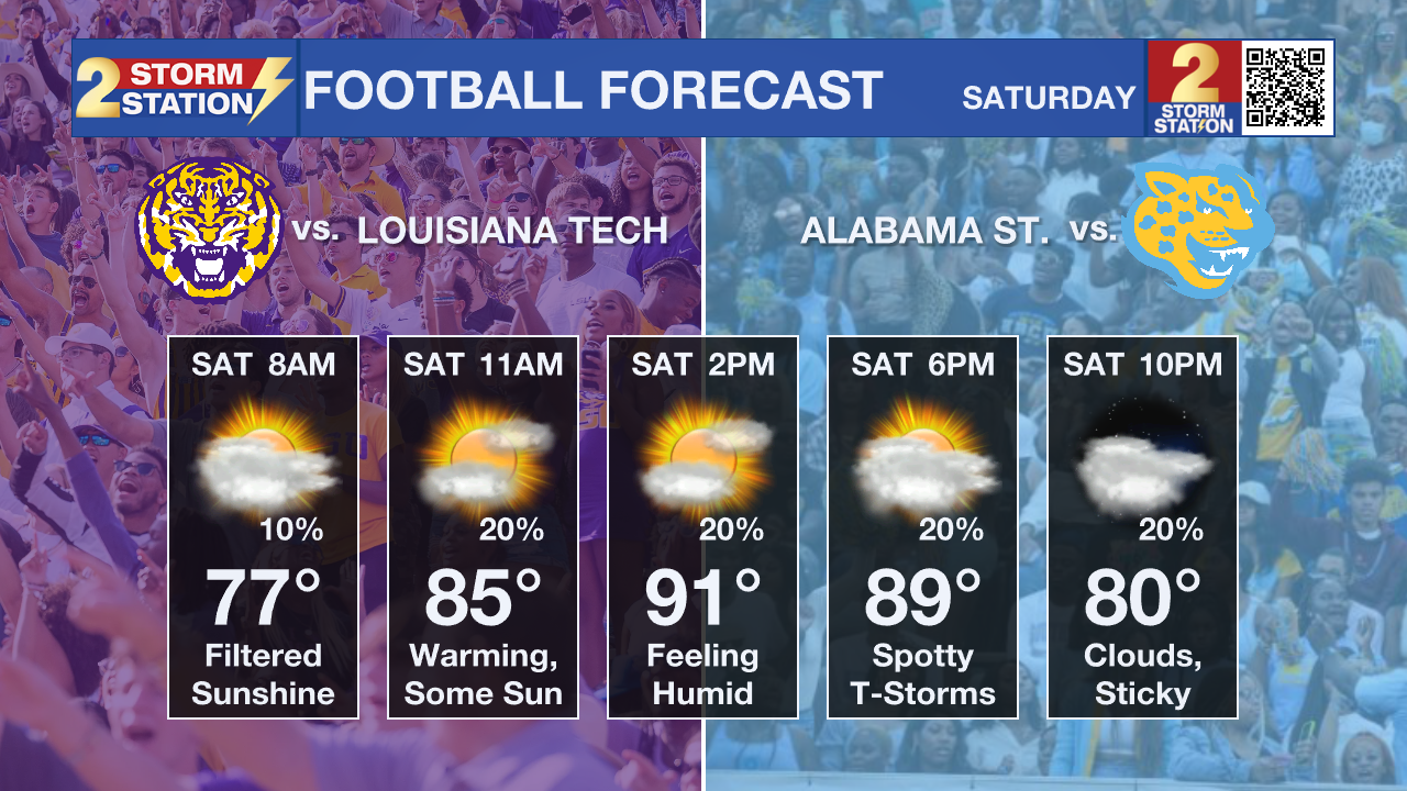
Football & Tailgating Weather: Be prepared for some steam and keep an eye out for those brief pop-up showers and thunderstorms. Of course, if there is lightning nearby (if you can hear thunder), find a safe enclosed shelter nearby. The good news is, if there is any precipitation, it should be very short-lived.
Up Next: The cold front will be working its way through the area on Sunday, so the chance for rain and humidity will start backing off through the afternoon. As drier and slightly cooler air filters in, highs may not get beyond the upper 80s. By Monday, drier and cooler air will settle in, bringing the first small taste of fall. Highs will stay in the upper 80s, but the bigger story will be the drop in humidity. Mornings will dip into the upper 60s on Monday, with mid-60s possible on Tuesday. If we hit those marks, it will be the coolest air in Baton Rouge since early June! That means crisp, refreshing mornings and much more pleasant evenings—perfect for some time outside before or after work and school.
Trending News
Highs will creep back into the lower 90s by the end of next week, but with humidity staying lower, it won’t feel nearly as oppressive as recent weeks. Rain chances will also be minimal, sitting at just 10% most days after Sunday.
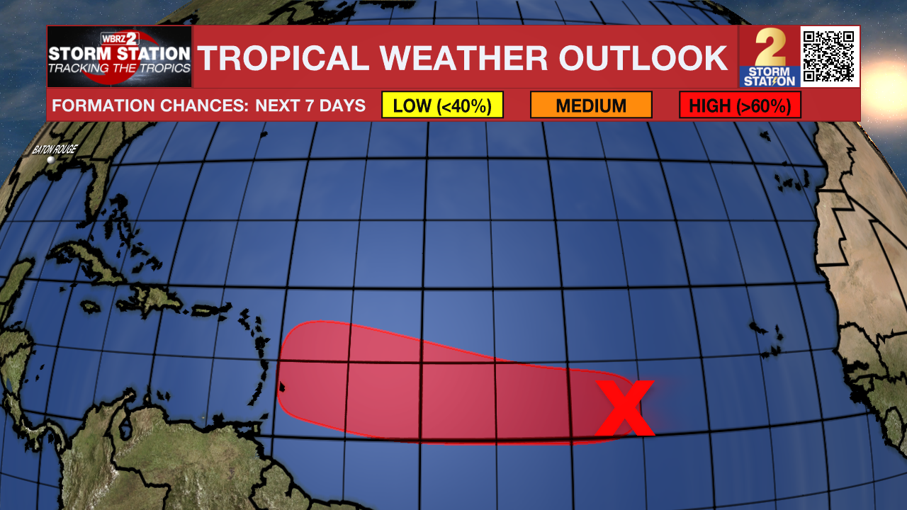
The Tropics: A tropical wave in the central Atlantic is producing disorganized showers and storms. Dry air may slow development in the short term, but conditions could allow a tropical depression to form early next week as the system moves west at about 10 mph. It may approach the Lesser Antilles by mid to late next week. As of now, there is no long-term threat to the Gulf Coast.
Get the latest 7-day forecast and real-time weather updates HERE.
Watch live news HERE.
– Josh
The Storm Station is here for you, on every platform. Your weather updates can be found on News 2, wbrz.com, and the WBRZ WX App on your Apple or Android device. Follow WBRZ Weather on Facebook and X for even more weather updates while you are on the go.
More News
