

Latest Weather Blog
LATEST: Attention shifts towards very cold air, and possible patchy ice on roadways
The freezing rain threat is over, and attention now shifts to towards very cold air, and possible patchy ice on roadways. Given ample drying time, most roads will be just fine, but a few patches of ice are still possible.
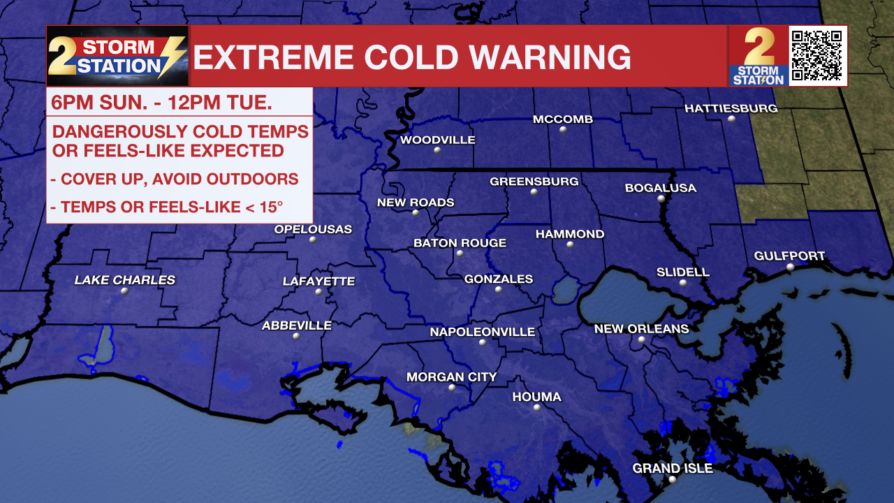
An ***EXTREME COLD WARNING***will go into effect at 6pm Sunday and last until 12pm Tuesday for all of southeast Louisiana and southwest Mississippi. Dangerously cold wind chills as low as 4°F are expected. Frostbite and hypothermia will occur if unprotected skin is exposed to these temperatures. An extended period of freezing temperatures could cause ruptured water pipes.
HOW WIND CHILL WORKS - INSIDE THE WEATHER WITH WBRZ CHIEF METEOROLOGIST, DR. JOSH EACHUS
Dress in layers including a hat, face mask, and gloves if you must go outside. To prevent water pipes from freezing; wrap or drain or allow them to drip slowly. Keep pets indoors as much as possible. Make sure outdoor animals have a warm, dry shelter, food, and unfrozen water. Make frequent checks on older family, friends, and neighbors. Ensure portable heaters are used correctly. Do not use generators or grills inside. If you do not have heat in your home or lack shelter, you can call 211 for assistance locating appropriate shelter from the cold. Use caution while traveling outside. Wear appropriate clothing, a hat, and gloves.
Trending News

Arctic Blast: Temperatures will get below freezing close to 6-7pm, and continuously drop. Lows will end up in the upper teens and lowers 20s, with wind chills in the single digits! Although there is a small risk for a few patches of ice, most roadways will be just fine. Sunshine returns during the day, but a continued northerly breeze will keep highs in the 30s. We get even colder overnight and on Tuesday morning as lows will be widespread in the teens. People, pets, plants, and pipes will need to be protected. Winds will thankfully not be as much of an issue here.
Up Next: Thermometers will finally break into the 40s during the day Tuesday. Temperatures will remain chilly through midweek, though the heart of the cold will be on its way out by then. There is already signs of another plunge of arctic air next weekend.
Get the latest 7-day forecast and real-time weather updates HERE.
Watch live news HERE.
The Storm Station is here for you, on every platform. Your weather updates can be found on News 2, wbrz.com, and the WBRZ WX App on your Apple or Android device. Follow WBRZ Weather on Facebook and X for even more weather updates while you are on the go.
More News
