

Latest Weather Blog
Sunday AM forecast: Dangerous Heat Continues Sunday; Little Relief Ahead
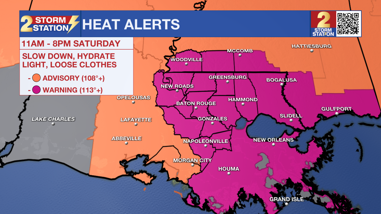
Dangerous heat will remain the main weather story, with an Extreme Heat Warning in effect as temperatures climb into the upper 90s and “feels-like” temperatures may reach 110 to 115 degrees. The heat continues into the workweek, but a shift in the upper pattern could bring better rain chances by the end of the week, which in turn, should lower temps a bit.

Today and Tonight: Lots of sunshine early in the day with clouds mixing in later this afternoon. The Extreme Heat Warning will be in effect from 11 AM through 8 PM. Overnight temperatures will only fall into the upper 70s and 80s, offering little opportunity for recovery from the daytime heat.
Trending News
A stray shower or thunderstorm could develop this afternoon, but rain will be the exception rather than the rule. Any storm that does form could provide a brief break from the heat, although it will feel very steamy once the sunshine returns.
Up Next: Dangerous heat will continue Monday, with another Excessive Heat Watch already posted. Highs will remain in the upper 90s to near 100, with heat index values potentially reaching 110 or higher.
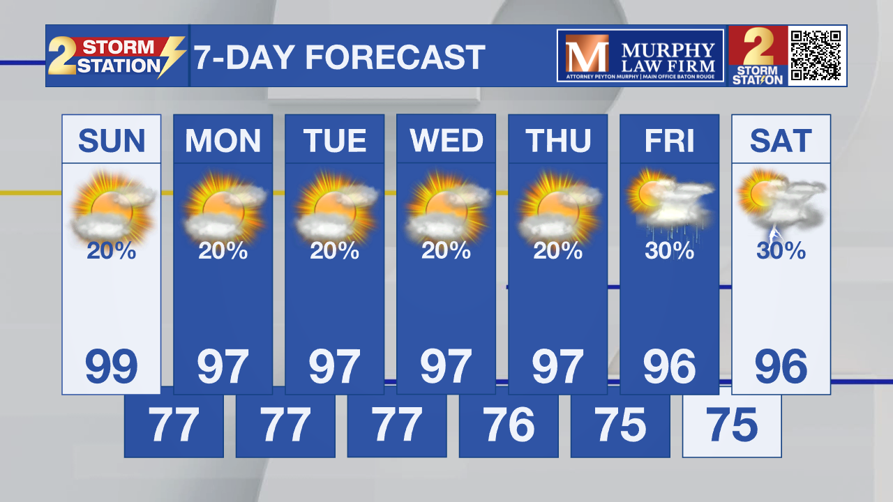
There are signs of some gradual improvement later in the week. The upper-level pattern is expected to shift, allowing more moisture and eventually better chances for afternoon storms. By Friday and Saturday, temperatures could ease closer to the middle 90s, which is still above normal for mid August.
Tropics: The Atlantic is quiet for now, with the National Hurricane Center saying tropical cyclone formation is not expected during the next seven days. That is a notable change from just a few days ago, when several tropical waves were being monitored across the Atlantic. Those systems struggled as they encountered increasing wind shear. That stronger shear may be partly related to the broader atmospheric pattern associated with El Niño, which can be hostile to tropical development across the Atlantic.
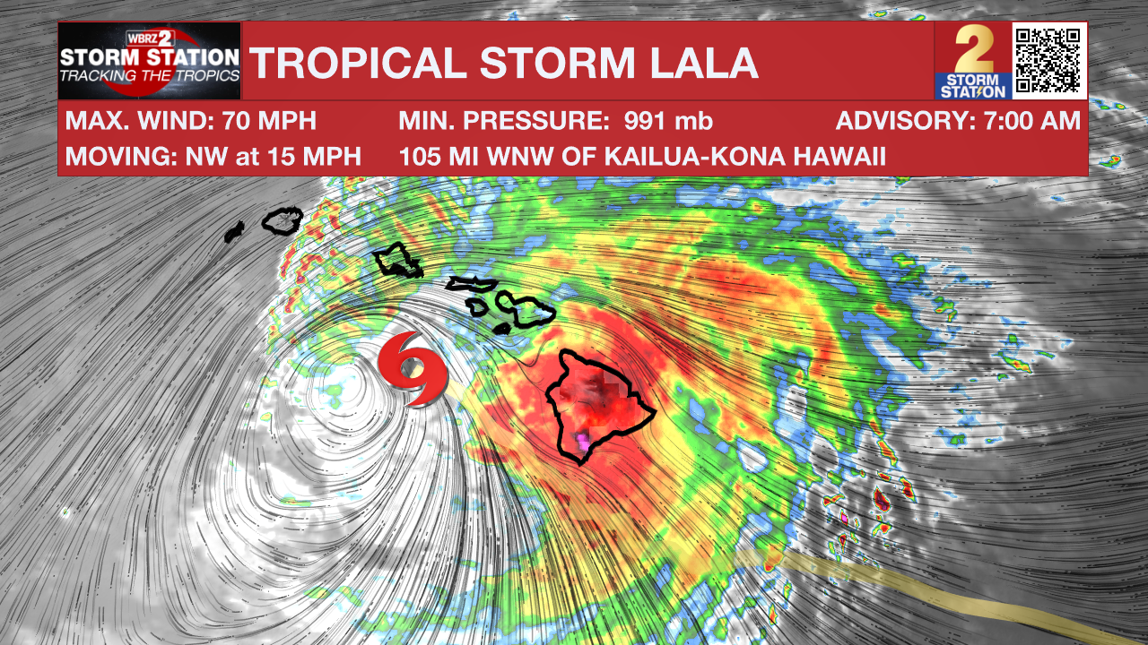
Meanwhile, Lala has been downgraded to a tropical storm and is moving away from Hawaii after bringing damaging winds and extremely heavy rain to the islands. Tropical-storm conditions and additional heavy rain are expected to spread westward across the Hawaiian island chain today.
Get the latest 7-day forecast and real-time weather updates HERE.
Watch live news HERE.
– Dave
The Storm Station is here for you, on every platform. Your weather updates can be found on News 2, wbrz.com, and the WBRZ WX App on your Apple or Android device. Follow WBRZ Weather on Facebook and X for even more weather updates while you are on the go.
More News

