

Latest Weather Blog
Wednesday PM Forecast: Halloween weather shake-up brings humidity, returning showers
Make the most of the crisp mornings and comfortable afternoons while they last. A spike in humidity toward the weekend will fuel showers and thunderstorms just in time for Halloween.
Tonight & Tomorrow: Skies will stay mainly clear into Thursday morning, allowing daytime warmth to escape fast. Following a start in the low 50s, sunshine will guide temperatures into the mid-80s by afternoon. High clouds will start mixing in as the day wears on, but dry conditions will prevail.
With dry air in place, fire danger remains elevated. Parched grass and brush would ignite easily from even a single spark, so obey all local burn bans and use caution with any equipment that could cause a fire.
The Next Impact: Muggy air will creep back into the area on Friday, starting at the coast and gradually spreading inland. The bump in humidity will take full effect over the weekend, setting the stage for the first real chance of rain since early October. While an isolated shower can't be ruled out late Friday, the bulk of the rain will target Halloween. Scattered, intermittent activity is the expectation as of now, and there could be spots that miss rain. However, the timing may be a nuisance. Lingering action into the evening might mean a few costumes get damp for trick-or-treaters. The exact timing of rain will come into better focus over the next day or two.
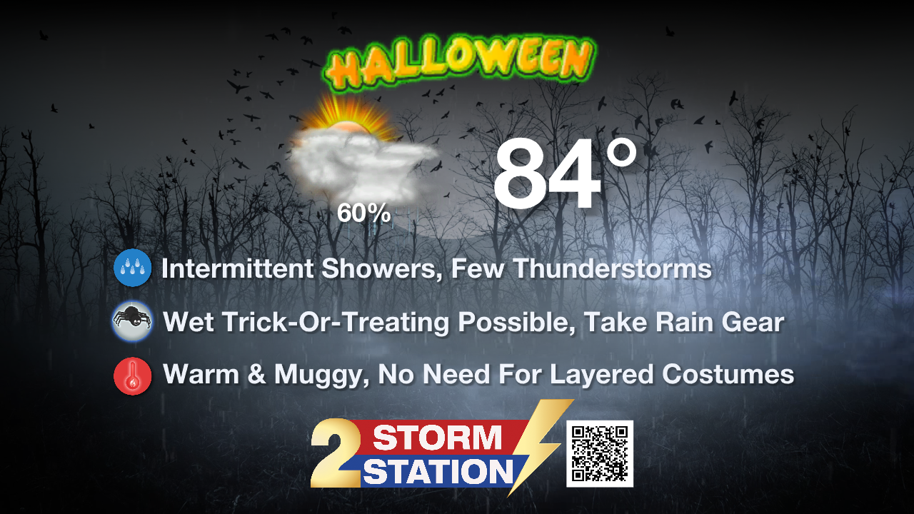
Up Next: While a spotty shower remains possible Sunday, rain chances will steadily taper off. Sunshine will break through and carry into Monday, with unseasonably warm highs lingering in the mid-to-upper 80s at times through early next week. Thanks to lingering humidity, lows will stay muggy in the mid-60s.

Trending News
The humid conditions will finally break toward midweek as a potent storm system sweeps across the South. It will bring another round of showers and thunderstorms, followed by a noticeable drop in temperatures behind a cold front. While the exact timing is still coming into focus, the cooler air should arrive by late in the week.
Get the latest 7-day forecast and real-time weather updates HERE.
Watch live news HERE.
The Tropics: The Gulf, Caribbean Sea, and broader Atlantic Basin remain completely quiet. No tropical development is expected over the next seven days.
— Meteorologist Malcolm Byron
The Storm Station is here for you, on every platform. Your weather updates can be found on News 2, wbrz.com, and the WBRZ WX App on your Apple or Android device. Follow WBRZ Weather on Facebook and X for even more weather updates while you are on the go.
More News

