

Latest Weather Blog
Sunday PM Forecast: Quiet & warm weather ahead, signs of a true fall front next weekend
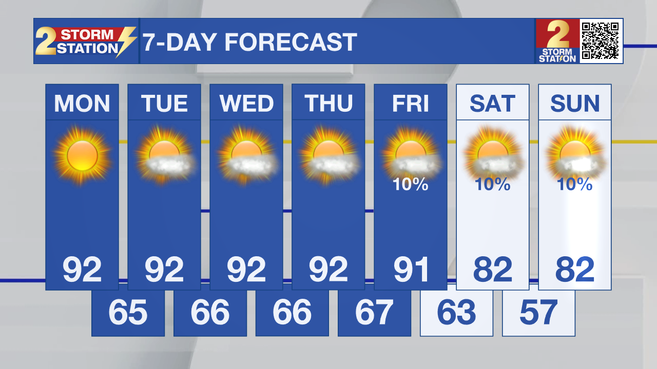
All of next week will be mainly dry with warm afternoons in the lower 90s. Looking ahead to next weekend, there are signs that a front could bring the coolest temperatures of the fall so far.
.png)
Tonight & Tomorrow: It will be another comfortable, but somewhat chilly night across the Capital Area with lows reaching into the lower 60s and upper 50s. A light jacket will be a good idea if heading out early! The daytime hours will be warm and sunny. Highs will reach near 92°, which is just three degrees shy of the record for the day. Thankfully, humidity levels will remain low.
Up Next: Not much change in the weather pattern is expected through the end of the workweek. Rain will basically be non-existent, with each day remaining warm and sunny. Lows will steadily uptick, until we are in the mid to upper 60s. This will be ahead of a front passage over the weekend. Most model guidance shows a front passage, but there are differences on how strong the front will be. Some guidance shows lows reaching the 40s, while other guidance reveals the upper 50s and lower 60s. The current Storm Station forecast is in the middle of these values, but further adjustments will likely have to be made. Thankfully, all guidance finally shows highs leaving the 90s. Even with a front passing through, rain looks unlikely.
Trending News
Get the latest 7-day forecast and real-time weather updates HERE.
Watch live news HERE.

The Tropics: An elongated area of low pressure centered a few hundred miles southwest of the Cabo Verde Islands is producing a large but disorganized area of showers and thunderstorms, extending from these islands southwestward into the eastern Tropical Atlantic. Environmental conditions appear only marginally conducive for some development of this system over the next day or two before upper-level winds become too strong for any further development by midweek. Regardless, heavy rainfall is expected over the next few days for portions of the Cabo Verde Islands as the system moves slowly northward to north-northwestward.
– Balin
The Storm Station is here for you, on every platform. Your weather updates can be found on News 2, wbrz.com, and the WBRZ WX App on your Apple or Android device. Follow WBRZ Weather on Facebook and X for even more weather updates while you are on the go.
More News

