

Latest Weather Blog
Thursday AM Forecast: Lower humidity values move in by this afternoon
While it will still feel humid this morning, drier air will filter in as the day progresses. This will cause lower heat index values and cooler lows over the next few days.
.png)
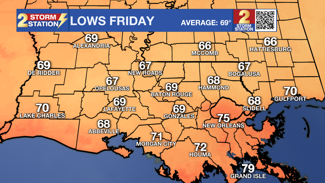
Today & Tonight: Thursday brings mainly clear skies and a steady breeze, with gusts from the east picking up to 15–20 mph. Afternoon highs will top out around 95 degrees, though a welcome drop in humidity will keep the mugginess at bay compared to earlier this week. Heat index values will max out at 95–100 degrees, a noticeable relief from the 100–105 degree range we've been seeing. Overnight, we will observe the lowest lows since early June. Many locations along and north of the 10/12 corridor will reach into the upper 60s. This is not jacket territory, but it will feel refreshing.
Trending News
Up Next: Following a crisp start to the day, Friday afternoon stays bright, dry, and warm, topping out in the mid-90s. Conditions look great for both Friday Night Blitz high school football and the Southern Jaguars game, with temperatures dropping through the 80s and into the 70s as the sun goes down. A few areas may even dip back into the upper 60s early Saturday morning.
Humidity begins to sneak back in by Sunday, gradually winding down this quick dose of autumn-like weather and providing enough daytime fuel to spark a few showers and storms. Rain chances remain fairly low through early next week, holding at or below 30% each day. Highs in the lower 90s and lows in the lower 70s will run a bit warmer than normal. Astronomical fall officially arrives on Tuesday.
Get the latest 7-day forecast and real-time weather updates HERE.
Watch live news HERE.

The Tropics: Showers and thunderstorms have become a little better organized over the past day in association with a small area of low pressure located a few hundred miles east of Bermuda. Environmental conditions could support some additional gradual development over
the next few days while the system moves slowly westward today, and then possibly turns southward on Friday over the subtropical Atlantic.
– Balin
The Storm Station is here for you, on every platform. Your weather updates can be found on News 2, wbrz.com, and the WBRZ WX App on your Apple or Android device. Follow WBRZ Weather on Facebook and X for even more weather updates while you are on the go.
More News

