

Latest Weather Blog
Thursday AM Forecast: Stormy pattern continues, Drying up for weekend plans
Periods of showers and storms will continue for southern Louisiana through the end of the workweek. By early Saturday, drier air will settle in for the weekend, making for a very pleasant transition from May to June.
Today & Tonight: A few showers and rumbles of thunder from overnight will linger around the area through sunrise Thursday. Once that batch of rain departs to the east, expect a temporary lull in radar activity. Through the rest of the day, rainfall coverage will be spotty to isolated across the region. Temperatures will warm into the mid-80s today under partly to mostly cloudy skies. The more sunshine that is able to break through the clouds today, the better the atmosphere will be able to produce afternoon storms. A strong storm or two capable of gusty winds and/or hail also cannot be ruled out. Keep raingear nearby and check the radar before heading out the door today. After sunset, rain chances decline and partly cloudy skies will remain. Look for morning lows on Friday in the low-70s.
Friday: One final batch of thunderstorms is expected on Friday as a weak front pushes south into the Gulf. As the front moves through south Louisiana, a few stronger storms with gusty winds may develop. Around 60% of the Storm Station's forecast area is expected to see measurable rain sometime on Friday. Behind the front, drier air will filter in as winds shift out of the north. For those heading to the LSU Baseball Regional on Friday, watch out for storms during LSU vs. Little Rock at 2pm. Expect storms to exit by Friday evening.
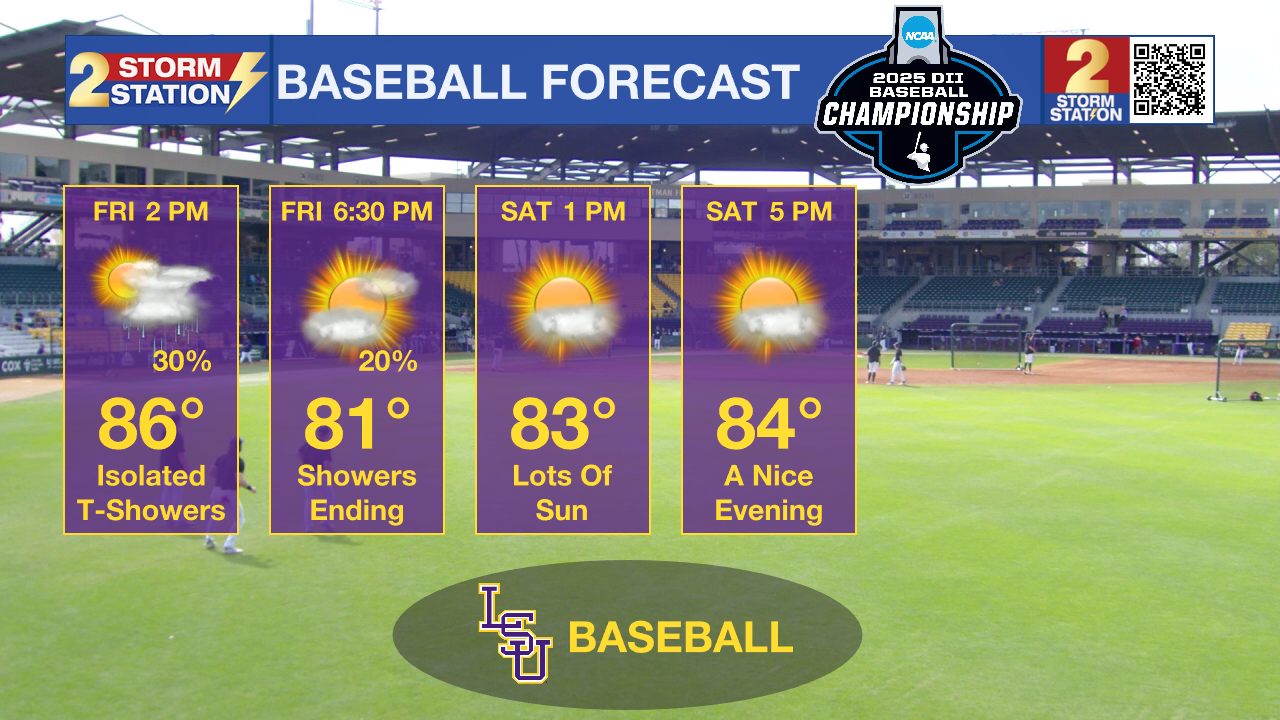
The Weekend: Although June begins on a Sunday, this weekend’s weather will be far more pleasant than usual for early summer. A cold front moving through on Friday will bring lower humidity and comfortable high temperatures in the mid-80s. Morning lows will also be cooler than average, dipping into the mid-60s on both Saturday and Sunday. Expect plenty of sunshine and a dry weekend ahead!
Next Week: Summertime heat and steam return quickly into the next workweek. Morning lows in the 70s and many afternoons near 90 degrees will dominate the forecast.
Trending News
Get the latest 7-day forecast and real-time weather updates HERE.
Watch live news HERE.
- Emma Kate C.
The Storm Station is here for you, on every platform. Your weather updates can be found on News 2, wbrz.com, and the WBRZ WX App on your Apple or Android device. Follow WBRZ Weather on Facebook and X for even more weather updates while you are on the go.
More News
