

Latest Weather Blog
Thursday PM Forecast: Gearing up for the first major fall cold front
A strong cold front sweeps through ahead of the weekend, ushering in ideal football weather for Friday night and Saturday. Beyond the crisp fall air, the front brings gusty winds, heightened fire danger, and hazardous boating conditions. Read the full breakdown in today's loaded forecast blog.
Tonight & Tomorrow: Skies will stay mostly clear through most of the night. Early morning fog has been common lately, but could be less of a widespread issue early Friday. A subtle bump in moisture aloft and passing high clouds will act as an insulator, limiting the widespread cooling required for thicker fog. Nevertheless, patchy fog cannot be ruled out in low-lying areas near bodies of water, particularly closer to the tidal lakes. Morning lows will stay mild, only bottoming out in the mid-60s.

Use the slider to advance through the next 24 hours of Futurecast
Friday brings a sharp transition as a strong cold front moves into the region. Afternoon temperatures will depend heavily on the timing of the front. Expect highs to peak in the upper 80s to near 90° around Baton Rouge and areas southeast, whereas a midday frontal passage to the northwest will likely cap temperatures in the mid-80s. As the front passes, a spotty shower cannot be ruled out, but most should miss rain. Temperatures will crash into the 70s in the wake of the front. Winds will pick up significantly behind the front, with light morning breezes increasing to 15–20 mph by late afternoon and persisting into the evening.
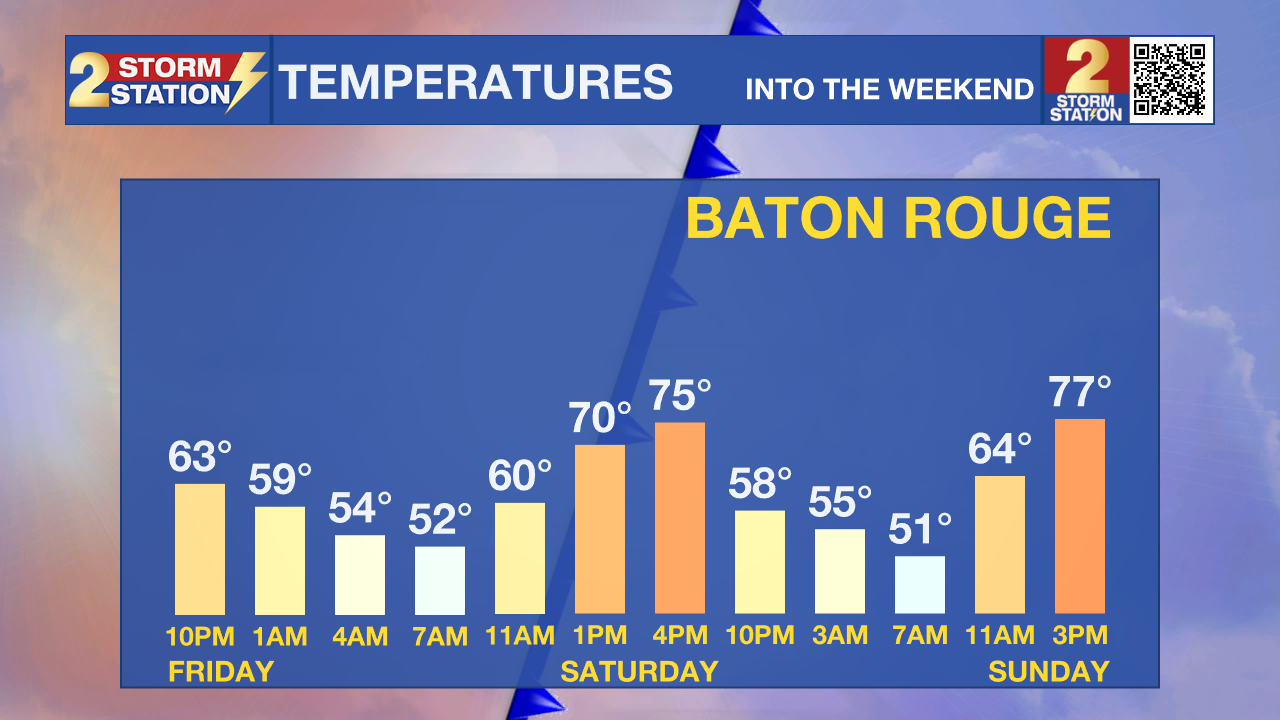
Weekend Temperature Tumble: Temperatures continue to dial down in the Storm Station forecast as the cold front now appears to be moving even faster. Saturday morning will start brisk in the upper 40s and low 50s, and daytime highs won't get much past the mid-70s. A northeast breeze will be noticeable at 10-20 mph. Sunday morning will feel just as cool, with low 50s and even more areas dipping into the 40s. Although Sunday afternoon will be the warmer of the two weekend days, highs will still stop several degrees short of 80°.
Friday Night Blitz & LSU Homecoming: Expect true football weather for both high school and college football matchups. With the cold front arriving Friday afternoon, kickoff temperatures now look to be in the low 70s. By the fourth quarter, expect a 10-degree drop into the low 60s. Definitely take an extra layer for the bleachers, and perhaps some lip balm thanks to the dry, breezy conditions.
Trending News
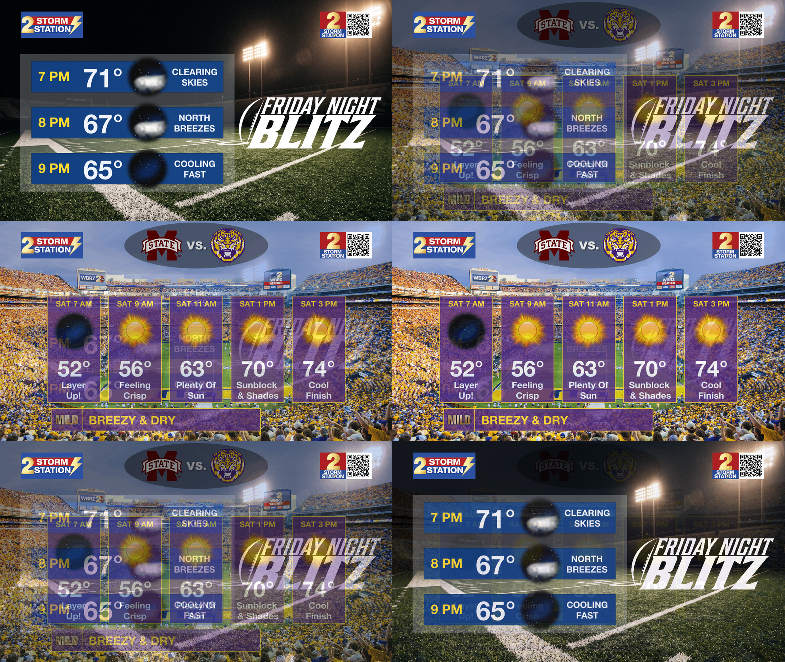
The same advice applies on Saturday. Early-bird tailgaters will need to dress for a chilly start in the low 50s. Expect sunshine and mid-60s around the 11:00 a.m. kickoff, with temperatures warming into the comfortable mid-70s by the time LSU wraps up a victory!
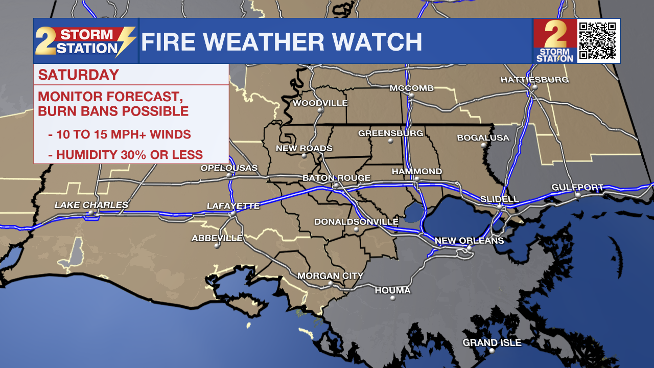
Fire Weather Danger: Saturday's dry, breezy weather brings a heightened fire weather risk. If a spark catches, the wind and dry air would make it spread fast. The highest risk comes during the day when the relative humidity bottoms out. Simply put, outdoor burning is not recommended. Any open flame outdoors must be monitored carefully, including while grilling. A Fire Weather Watch is already in place for Saturday and could be upgraded to a Red Flag Warning later in time.
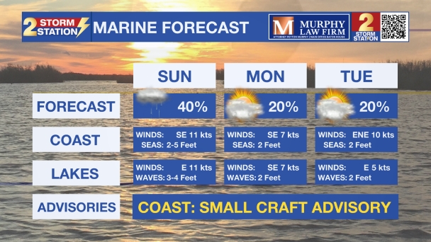
Hazardous Marine Conditions: Anyone planning to be on the water Friday into Saturday may want to reconsider, especially inexperienced mariners and those operating smaller vessels. A Gale Watch is in effect as gusty winds generate rough, choppy conditions across local waterways.
Up Next: Following the significantly cooler weekend, temperatures will slowly rebound next week. Dry air will remain in place, however, keeping rain chances generally slim.

Get the latest 7-day forecast and real-time weather updates HERE.
Watch live news HERE.
The Tropics: No tropical development is expected over the next seven days in the Atlantic, Gulf, or Caribbean.
— Meteorologist Malcolm Byron
The Storm Station is here for you, on every platform. Your weather updates can be found on News 2, wbrz.com, and the WBRZ WX App on your Apple or Android device. Follow WBRZ Weather on Facebook and X for even more weather updates while you are on the go.
More News

