

Latest Weather Blog
Tuesday AM forecast: Fog early, then sunny. Cooler weather on track for the weekend
Another sunny, unusually warm day is ahead for Baton Rouge. The heat continues through the workweek, but a cold front arriving Friday night should finally bring a noticeable change for the weekend.

Today and Tonight: Patchy dense fog is the main concern early this morning, especially in low-lying areas and near waterways. A Dense Fog Advisory remains in effect until 9 a.m. for parts of the region, so allow extra time for the morning commute if visibility is reduced.

Use the slider to advance through the next 24 hours of Futurecast
Once the fog clears, expect plenty of sunshine and highs climbing into the lower 90s. Skies will stay mostly clear tonight, with temperatures dropping into the 60s.
Trending News
Up Next: The sunshine and unusual warmth continue through Friday, with highs in the upper 80s to lower 90s and little to no chance of rain. Another round of patchy fog could develop early Wednesday morning.
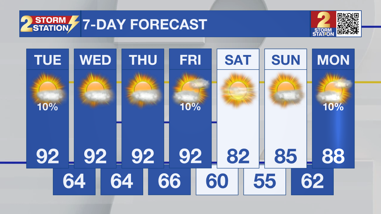
A cold front will move through Friday night, bringing cooler air but very little, if any, rainfall. By Saturday and Sunday, highs should settle into the lower 80s, with overnight lows dipping into the 50s inland. It will finally feel more like fall across the Capital Region.

Tropics: The National Hurricane Center says development of a disorganized low-pressure system in the eastern tropical Atlantic is becoming unlikely as stronger upper-level winds move in. The chance of tropical development has dropped to 10% over the next 48 hours and through the next seven days.
- Dave
Get the latest 7-day forecast and real-time weather updates HERE.
Watch live news HERE.
The Storm Station is here for you, on every platform. Your weather updates can be found on News 2, wbrz.com, and the WBRZ WX App on your Apple or Android device. Follow WBRZ Weather on Facebook and X for even more weather updates while you are on the go.
More News

