

Latest Weather Blog
Tuesday PM Forecast: steam relief expected with drier conditions Thursday to Saturday
The first signs of steam relief are ahead as a weak front will push through the Baton Rouge Area on Wednesday. To end the week, triple-digit heat index values will break thanks to noticeably drier air. While afternoon temperatures will still top out in the mid-90s, lower humidity will make outdoor activities much more enjoyable.
September Sizzle: highs reach the mid-90s, just a few degrees shy of records
Drier Trend: several days without rain likely later in the week
First Taste of Relief: a noticeable dip in humidity is expected late week into the weekend
.png)
Trending News
Tonight & Tomorrow: Conditions will stay sticky and warm overnight as low temperatures drop to the mid 70s. Skies will end up mostly clear. Wednesday will be steamy with highs reaching for the mid-90s and feels-like temperatures between 100 – 105 degrees. A weak front—defined by a wind shift and lower humidity—will push into the region later in the day. The front will stir up some clouds and possibly even thunderstorms, especially south and east of Baton Rouge. With plenty of heat energy to tap, the few thunderstorms that do get going could produce gusty wind.
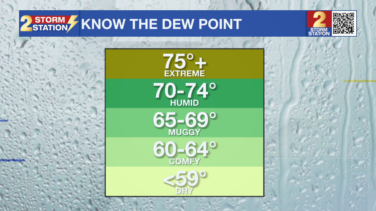
Up Next: A sensible and perhaps welcome change will be felt on Thursday through Saturday on the other side of the weak front. The dew point temperatures will slide out of the mid 70s and into the mid 60s.
 |
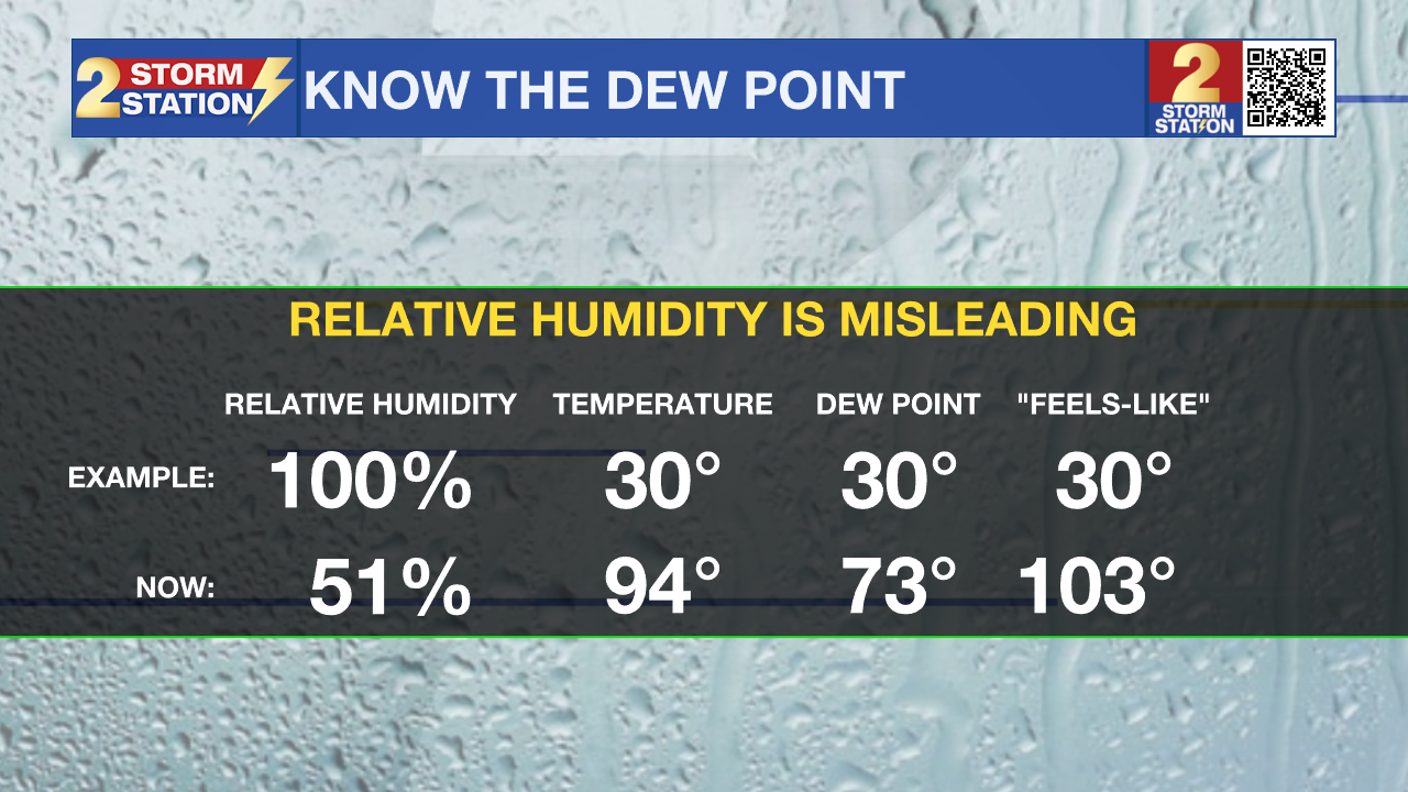 |
Recall that the dew point temperature serves as a much truer gauge of the humidity, as the relative humidity is just that, relative to the temperature, making it a sliding scale. The dew point temperature scale does not change, so when the numbers are in the 70s, it is humid, and when the numbers are in the 60s, it feels drier.
While daytime highs will still reach the mid 90s, the drop in humidity will make a difference. The heat index, or feels-like temperature, will essentially be whatever the thermometer reads, unlike the very humid days early in the week that produced a heat index in the 100s. Just by lowering the humidity a little, our bodies will experience a feels-like reduction of 10-15 degrees. Overnight low temperatures will manage to reach the low 70s, and some upper 60s will even be possible north and east of Baton Rouge.
Enjoy the dry streak while it lasts, because moisture will gradually creep back by Sunday. Expect isolated to scattered showers and thunderstorms to return as well as we approach Astronomical Fall on Tuesday.
Get the latest 7-day forecast and real-time weather updates HERE.
Watch live news HERE.

The Tropics: The Caribbean and Gulf will remain quiet over the next 7 days. Out in the central Subtropical Atlantic, a disturbance located about 800 miles east-southeast of Bermuda has been producing disorganized showers. Conditions will become somewhat favorable for gradual development later this week, and there is a forty percent chance that a tropical depression could form as it moves slowly west-northwestward over the open Atlantic Ocean.
– Josh
The Storm Station is here for you, on every platform. Your weather updates can be found on News 2, wbrz.com, and the WBRZ WX App on your Apple or Android device. Follow WBRZ Weather on Facebook and X for even more weather updates while you are on the go.
More News

