

Latest Weather Blog
Wednesday PM Forecast: Patchy dense fog, showers signaling the approach of a cold front
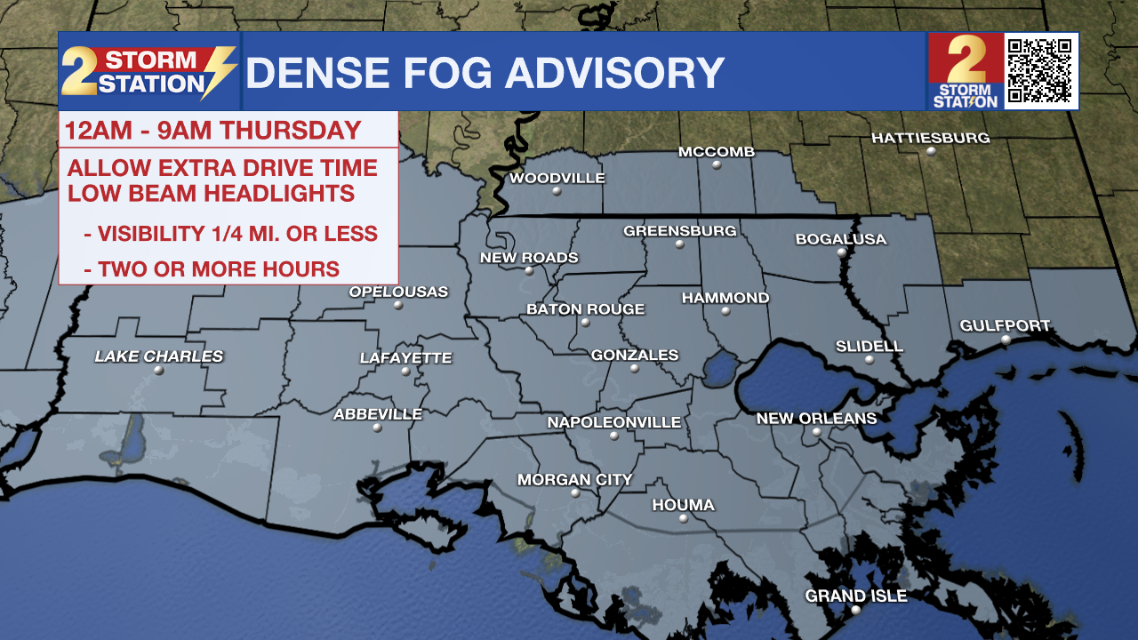
Fog and a few showers will be possible on Thursday ahead of another cold front. Its passage will bring a brief, one-day dip in temperatures before the heat builds back in through the weekend and into Christmas week.
Tonight & Tomorrow: Clouds will persist for a good chunk of the night. The occasional sprinkle can’t be ruled out any time, but rain chances will tick up a little higher closer to daybreak. Spotty to isolated showers will be possible for the morning commute. Patchy dense fog might also develop, especially in areas that manage to see some late-night clearing. A Dense Fog Advisory has been issued area-wide to account for this potential from midnight to 9 a.m. Thursday. With a few slick spots possible and reduced visibility at times, use caution on the drive into work. Lows will be incredibly mild, settling in the upper 50s.
Sunshine will emerge as showers clear by late morning. Showers will clear, and sunshine will emerge by late morning. That will send afternoon highs into the mid to upper 70s. The warmth comes ahead of another cold front by evening. A broken line of showers and storms will move through with the front and could impact portions of the evening commute for a select few. Conditions will quickly improve afterward, with clearing skies expected into the night.
Friday & The Weekend: Northerly winds will keep temperatures relatively cooler on Friday despite full sunshine. After waking up to a low in the low to mid-40s, highs will rebound into the 60s by afternoon — normal by mid-December standards. Winds will quickly return out of the south into the weekend, however. Highs will return to the 70s on Saturday and Sunday. The first half of the weekend looks dry, but by Sunday, increasing moisture may spark isolated showers and storms during the day.
Christmas Week & Day: An expansive ridge of high pressure will take over next week, working against rain and keeping temperatures elevated. Baton Rouge will likely remain in the 70s with lows in the 50s all week long, even on Christmas Day.
Trending News
Get the latest 7-day forecast and real-time weather updates HERE.
Watch live news HERE.
— Meteorologist Malcolm Byron
The Storm Station is here for you, on every platform. Your weather updates can be found on News 2, wbrz.com, and the WBRZ WX App on your Apple or Android device. Follow WBRZ Weather on Facebook and X for even more weather updates while you are on the go.
More News
