

Latest Weather Blog
Tuesday AM Forecast: A cool start, but warming up and getting humid
Another comfortable start to the day with dry, slightly cooler air still in place. By midweek, Gulf moisture will creep back in, and a brief shower can’t be ruled out for eastern areas.
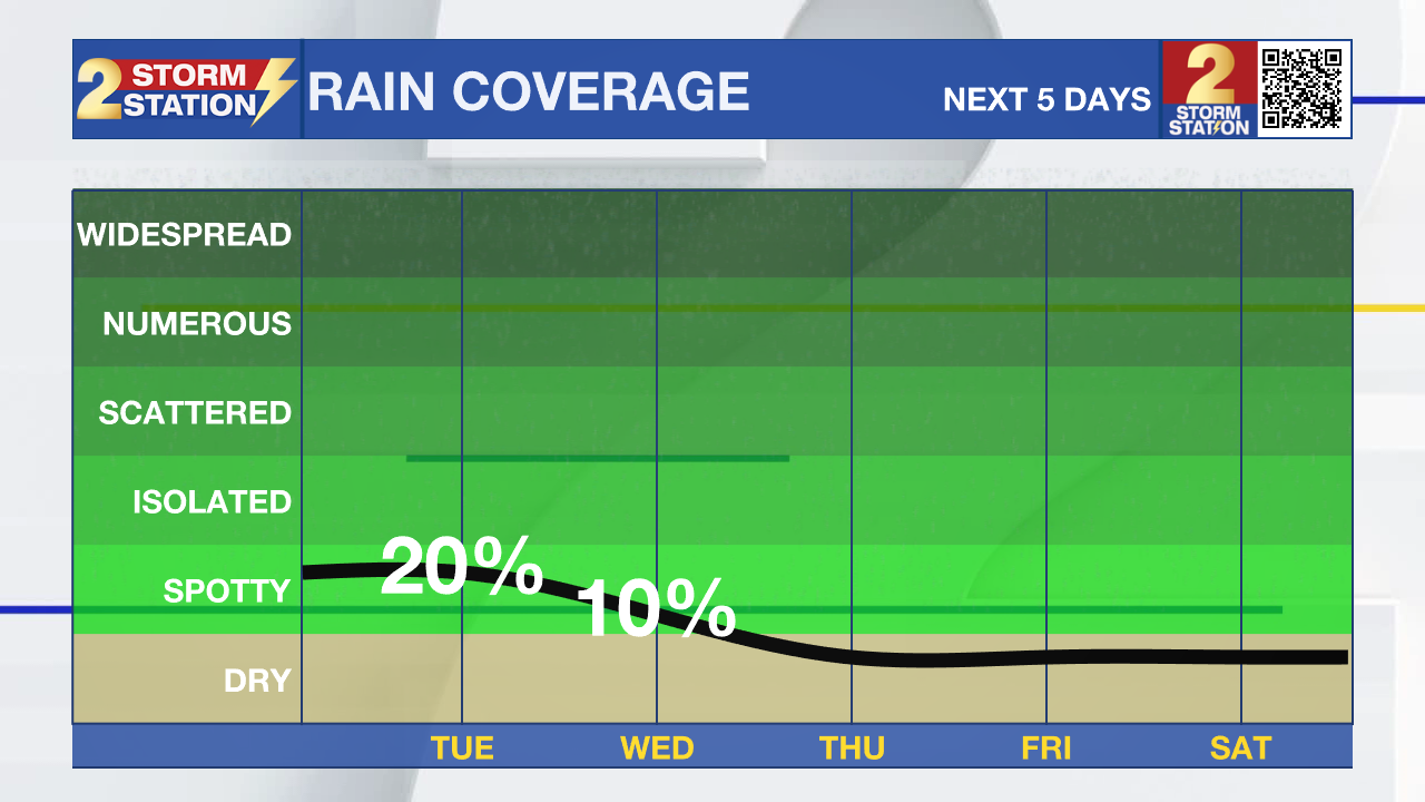
Today and Tonight: Sunshine and mild morning temperatures will set the tone to start the day. The fall-like feel lingers through midday before a touch of humidity returns. A few clouds may develop in the afternoon with highs near 90. A spotty shower is possible, especially near the lakes and in the coastal areas. Tonight, added humidity and some cloud cover will keep lows a bit warmer than recent nights.
Up Next: Higher humidity will make Wednesday feel more summer-like, though rain chances remain very low. Another round of drier air is expected late week into the weekend. Afternoon highs will climb into the lower 90s, but heat index values should stay reasonable. Over the weekend, sunny skies will keep things warm during the day, with nighttime lows dipping back into the 60s for many areas.
The Tropics: A few weak tropical waves are moving across the Atlantic basin, but the National Hurricane Center does not anticipate any development over the next seven days.
Trending News
Get the latest 7-day forecast and real-time weather updates HERE.
Watch live news HERE.
– Dave
The Storm Station is here for you, on every platform. Your weather updates can be found on News 2, wbrz.com, and the WBRZ WX App on your Apple or Android device. Follow WBRZ Weather on Facebook and X for even more weather updates while you are on the go.
More News
